
Note: NOAA Weather Radios will be down for today and Tuesday due to maintenance. This means it will not go off if a warning is issued for you. Have other ways to receive warnings if they are issued such as the Wireless Emergency Alerts on your phone, mobile apps. Do not rely on sirens as a way to get warnings.
This Afternoon/Evening:
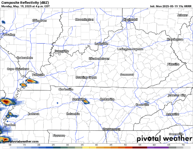
Scattered showers and storms will be possible thru the evening. One or two storms may be strong to severe with damaging straight-line winds and hail. No tornado worries today.
HRRR model gives a guess on what the radar could look like.
Tuesday will be the main day to stay weather aware – as multiple rounds of severe weather will be possible. While there is still some uncertainty on exactly how things unfold, it will be important to stay connected throughout the day.
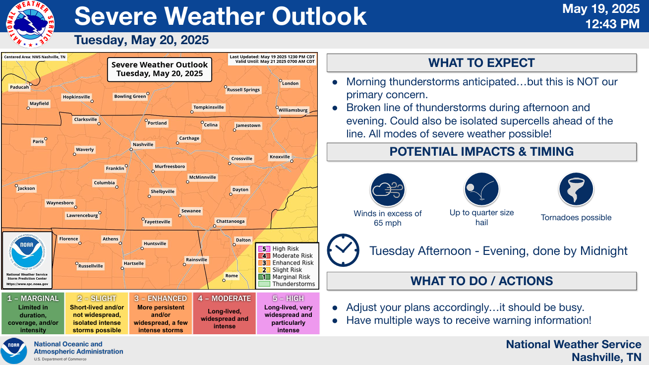
Both of our counties have been outlooked with the probability of ‘x’ occurring within 25 miles:
- 45% chance of damaging straight-line winds (58 mph+)
- 15% chance of severe hail (1″+)
- 10% chance of a tornado (one or two could be strong, EF2+)
Tuesday Morning – Midday:
While this is not the main show, we could see a few strong to severe storms during the earlier timeframe of Tuesday. This would likely be more of a gusty wind and hail threat – and could impact the AM commute to school/work.
Tuesday Early Afternoon – Evening:
How the morning round plays out will dictate a lot of how our “main show” plays out. If the morning round is able to move out quick enough for the atmosphere to destabilize, then all modes of severe weather would be possible. If the morning round hangs on a little longer than expected, severe weather would still be possible, but lesser of a threat.
Initially in the afternoon, isolated supercells are expected to form across the area. With these, all modes of severe weather would be possible including the threat for a strong tornado or two. Eventually, these isolated cells will come together and form a line, in which damaging straight-line winds will become the main concern, although hail and a tornado will still be possible.
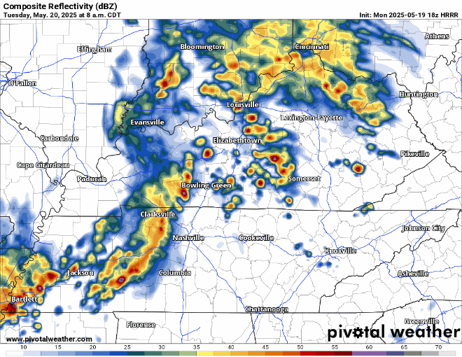
This is just one run of the HRRR model, but it gives a general idea of how things could turn out tomorrow:
AC/DC Goers: While you won’t get shook all night long by storms, the first portion of the evening might be rough. Traveling to stadium may include dodging potentially severe storms, which is never ideal. Nissan Stadium has a great storm shelter if needed, and the officials will be watching closely. I think things begin to clear up closer to 9p and onward – but that could change as well. Stay connected for updates, don’t get Thunderstruck.
Stay connected for updates. We’ll be looking at model data and then observations to see how the morning round of storms may affect the later round. In the meantime, know your safe place, know where you live on a map, know the difference between a Watch vs. Warning, and tell a friend to tell a friend. What To Do: Tornado Watch vs. Warning | Nashville Severe Weather
We’ll go live on YouTube if a warning is issued for any portion of our two counties. We’ll also post updates on all of our socials as needed.
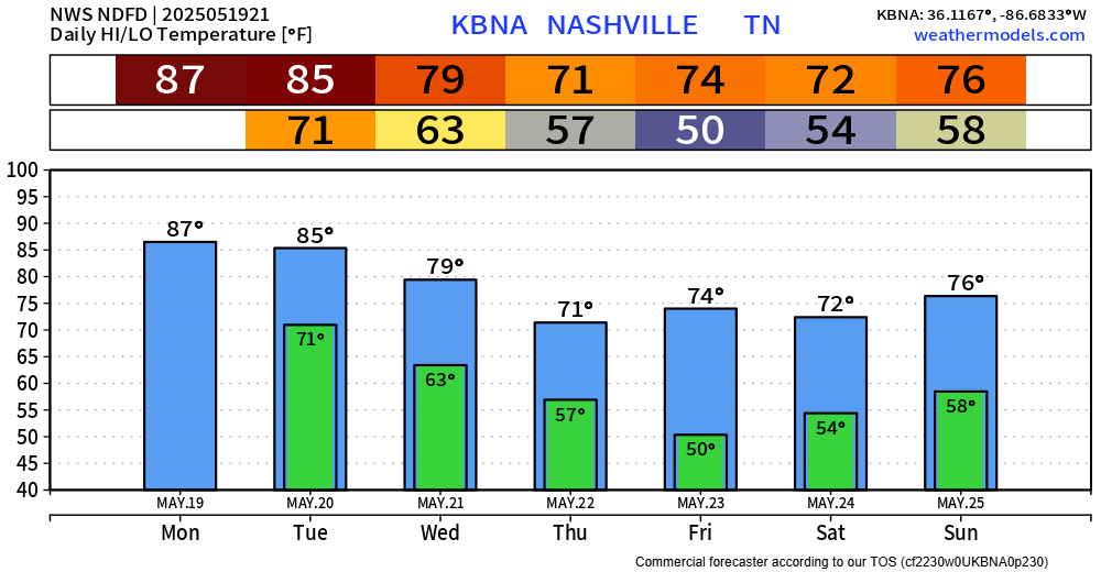
Cooler temps are drier weather will accompany us after Tuesday. Rain chances don’t return to the forecast until maybe Saturday.
Categories: Featured Blog