
Nice weather today and most of Sunday. Although a few of us may see a quick shower/storm Sunday afternoon, I think majority of us get by with a dry weekend. Highs in the mid 80s.
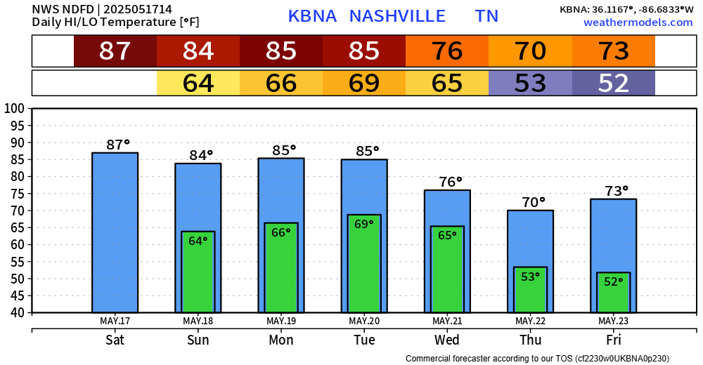
Not much of a break from storm chances as they return to the forecast on Monday.
Most likely from mid-morning thru the afternoon, thunderstorms will be possible, some could be on the strong side with gusty winds and small hail. Not worried about tornadoes.
Severe weather returns to the forecast on Tuesday.
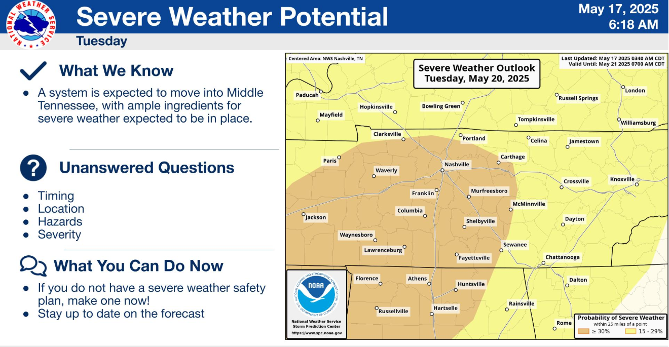
For now, both our counties are outlooked with a 30% chance of severe weather within 25 miles.
While there is still a good bit of uncertainty, it appears that all ingredients will be available for all modes of severe weather. Specifics on timing, hazards, severity are still up in the air. Best guess right now would be sometime Tuesday PM. We’ll be watching this and how it evolves and will keep y’all posted.
Wednesday brings one last day of rain chances before a cold front sweeps thru and brings drier and cooler conditions for the rest of the week.
Categories: Featured Blog