
Today will be hot and (probably) dry. Very, very, very low chance of storms thanks to a “cap” in place – which is just a layer of warm, stable air aloft. Highs near 90°.
Friday morning we could see some showers/storms move thru, most likely between 3a – 9a. Gusty winds, small hail and lightning not out of the question with these. Allowing some extra time for the AM commute not a bad idea.
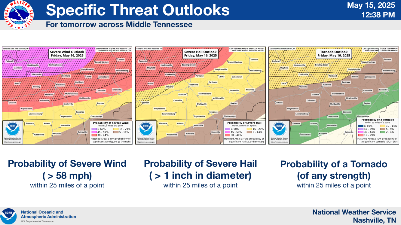
Friday afternoon – night will be the timeframe for potential severe weather.

Both our counties are outlooked with the following probs of ‘x’ within 25 miles:
- 30% chance of damaging straight-line winds (some gusts could be 70 mph+)
- 15% chance of severe hail (1″+)
- 5% chance of a tornado
Friday Afternoon:
While models expect very little to no storm development during this time thanks to our atmosphere being “capped” – models also can be wrong. If any storms are able to develop, they would likely be supercells capable of all modes of severe weather. Again, while not currently expected, this is something that will be watched closely.
Friday Night:
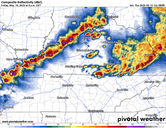
An “I-24 Special” rolling down sometime between 9p and 2a (timing subject to change), will be our main focus after we get done watching the radar Friday afternoon. This line of storms will be capable of all modes of severe weather, with damaging straight-line winds being the main threat. Hail and embedded tornadoes are less likely, but still possible.
Radar won’t look exactly like this, but the HRRR model gives a decent general idea.
Stay weather aware on Friday. Changes to the forecast, timing, hazards are all possible. We’ll be sending out updates as needed on all of our socials and will go live on our YouTube channel if any portion of our two counties goes under a warning. Stay connected!
Rest of the Weekend:
Rain should be long gone by Saturday morning, and we’ll be left with a nice rest of the day.
Low to medium rain/storm chances return Sunday afternoon. No severe weather expected.
Next Week:
Daily rain/storm chances will be in the forecast Monday thru at least Thursday – mainly in the afternoons/evenings. Highs in the low to mid 80s – pretty typical Springtime pattern.

Categories: Featured Blog