


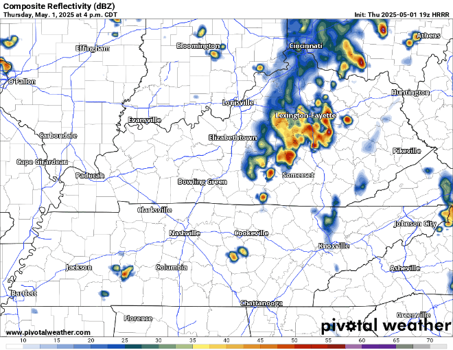
An isolated shower/storm will be possible thru this evening, with a low chance of a storm reaching severe criteria. Only hazards today would be gusty winds and/or small hail. Not worried about tornadoes today.
HRRR model, shown below, sends a rouge storm in here sometime this evening. May or not may happen. Stay connected if you have any outdoor plans.
Rain/storms seem more likely on Friday, with a relatively low chance of said storm reaching severe criteria.
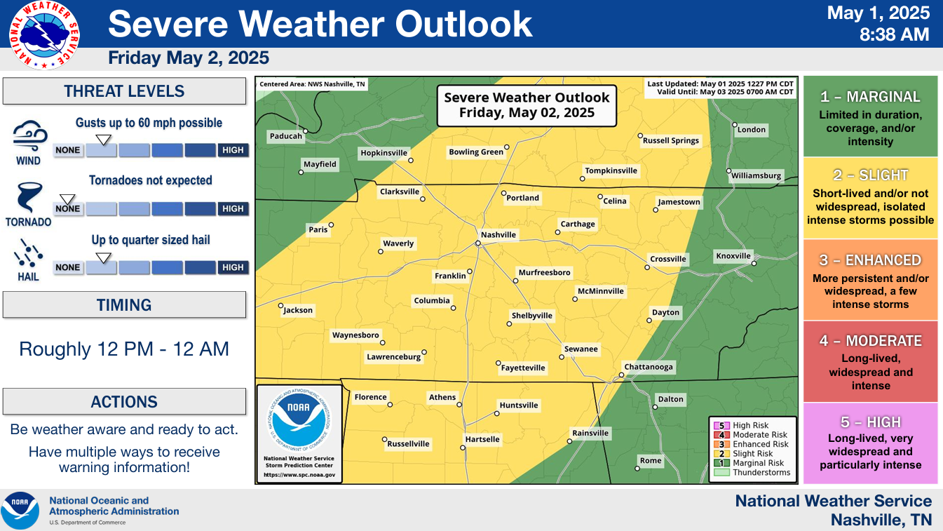
The Storm Prediction Center has our two counties outlooked with:
- 15% chance of damaging straight-line winds within 25 miles
- 15% chance of hail within 25 miles
- 2% chance of a tornado within 25 miles
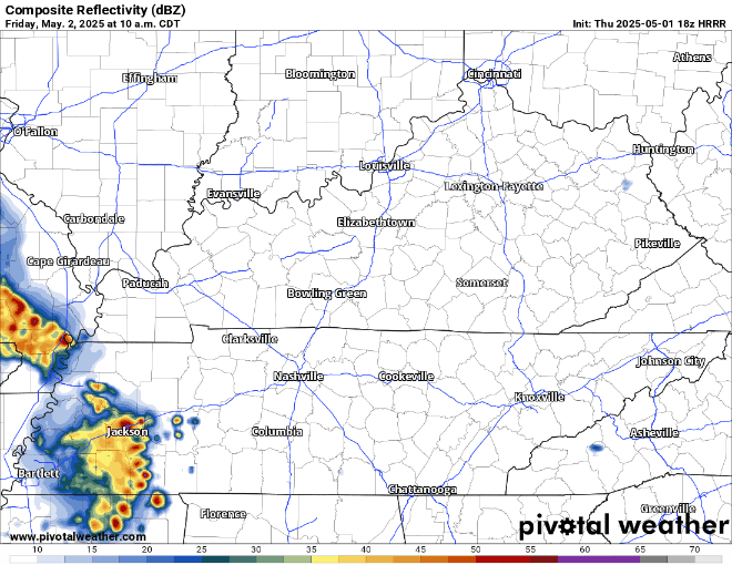
HRRR model thinks multiple rounds of showers/storms will be possible starting around noon on Friday, lasting thru the evening. Rolly ball fields may be in jeopardy. If you have any outdoor plans, stay connected tomorrow.
This looks nothing like a widespread severe weather event, but worth keeping an eye on tomorrow – we’ll keep y’all posted.
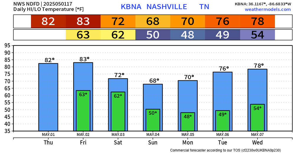
Majority of Saturday should be dry, besides a few scattered showers taking their time in the morning. Looks like any afternoon plans and onward should be okay.
Added bonus – temps cool down a bit for the weekend and continue thru the beginning of next week. We should stay dry until at least mid-next week.
 Log In To Facebook To Comment