
As new model data continues to come in, thinking on timing and coverage of rain/storms has changed a bit from previous days.
Still think most of us stay dry today (Wednesday) with the exception of maybe a quick shower or two for a few folks. No severe weather expected, and any shower/storm would collapse fairly quick.
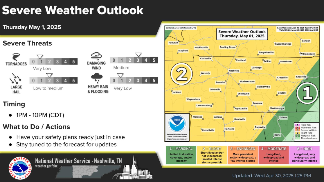
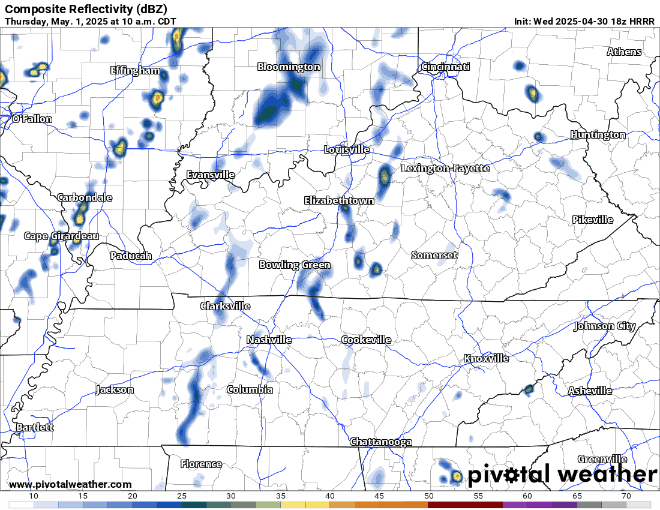
All week models have pointed at Thursday being “the” day for rain. New data has really backed off on rain/storm chances – and points towards a conditional storm threat.

The main focus would be on damaging straight-line winds and hail – with the tornado threat being very, very, very low but nonzero.
Again, this is a conditional threat – meaning you may not even see rain at all on Thursday, which the HRRR model thinks is certainly possible:
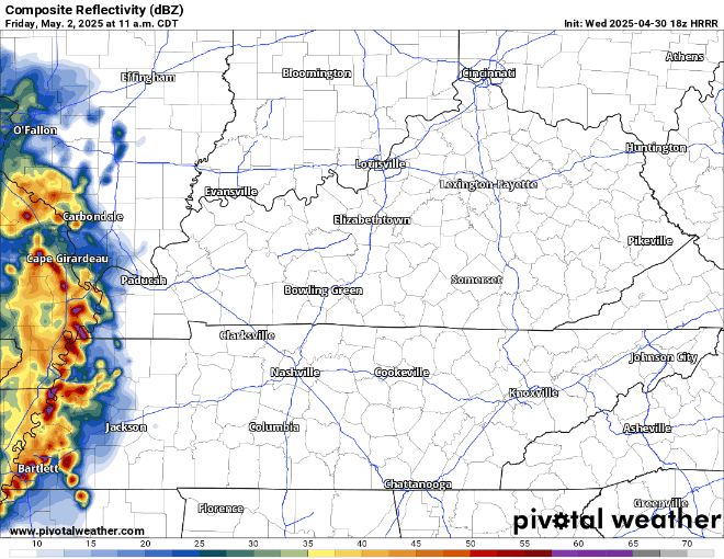
More of the same deal for Friday. Scattered showers/storms with maybe a couple being strong with gusty winds and/or hail.
HRRR model only goes out to 1p on Friday for now, but paints us this picture at that time:
Yesterday, I noted that the Euro model was sort of the outlier, keeping rain chances with us thru Saturday. Now, other models have caved to this idea and keep scattered rain chances with us thru about noon on Saturday.
“However, this again is low-confidence as medium range guidance isn`t in very good agreement” says NWS Nashville, so take this with a grain of salt. Models should start to come into somewhat of an agreement in the coming days.
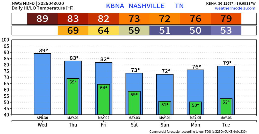
Thinking on temps cooling down as we get into the weekend remains the same.
Categories: Featured Blog