


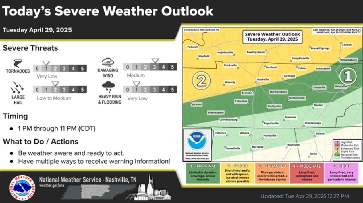
Random scattered showers/storms will be possible thru this evening. Although most should be below severe limits, one or two may produce some gusty winds and hail. The atmosphere just doesn’t look supportive of tornadoes today for us.
Not everyone will see rain, but those that do could see a good bit of it in a short amount of time.
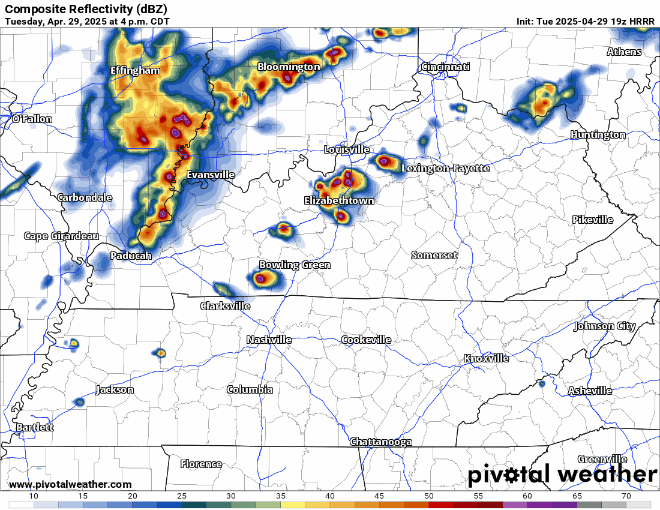
HRRR gives a guess:
We’ll be sending out any updates as needed on all of our socials. You can check the radar anytime on our website here: Radar | Nashville Severe Weather
HRRR model, amongst others, thinks we stay dry Wednesday – but still can’t totally rule out a quick shower/non-severe storm.
Our highest rain chances of the week show up Thursday (60-70%), when most of us should at least see a little rain.
Similar to today (Tuesday), while most storms should behave, a few could be strong with some gusty winds and/or hail. Not worried about tornadoes.
Most likely in the afternoon/evening – with maybe a few showers in the morning, Euro model guesses below. Impossible to nail down exact timing right now.

As for Friday:
“The front will linger over the area on Friday and that will keep showers and thunderstorms in the forecast with the best chances over the southeast…we still could see an isolated strong storm during the afternoon” says NWS Nashville.
Weekend weather looks great: cooler and dry. It’s worth noting that the Euro model keeps some showers in the area thru about midday Saturday, but as of right now this looks like an outlier.
 Log In To Facebook To Comment