
TL;DR:
- Scattered afternoon showers/storms possible Tuesday, Wednesday, and Friday afternoons/evenings
- Widespread showers/storms likely Thursday PM
- Relatively low chance of a strong to severe storm on Tuesday and Thursday
- Hot temps all work week before a “cool” down before the weekend
Rain chances will return Tuesday afternoon, although most of the activity is expected to stay to our north.
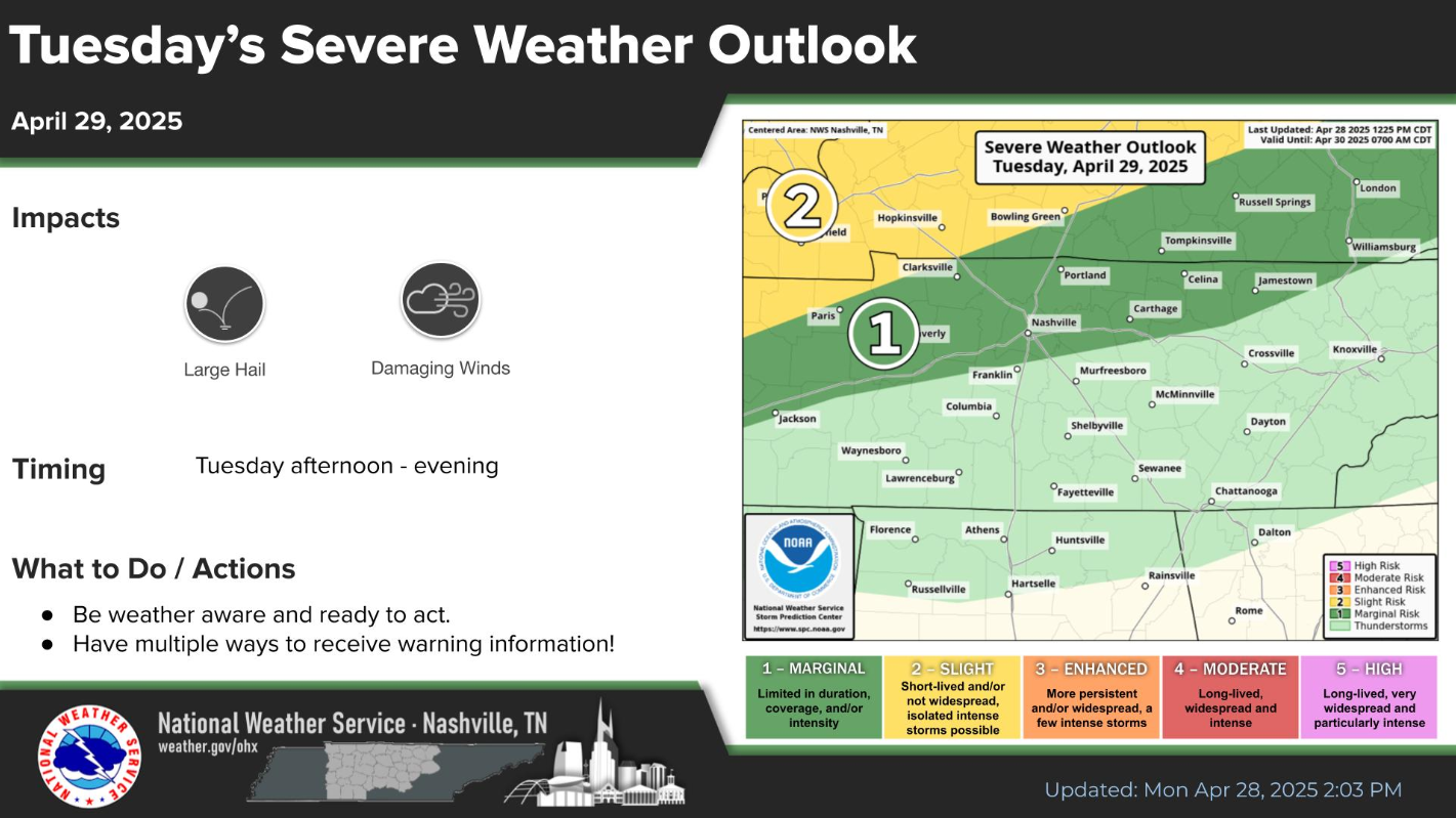
However, with any storm that does make it this far south, we’ll have a very low chance of a strong to severe storm, with gusty winds and hail being the concerns.
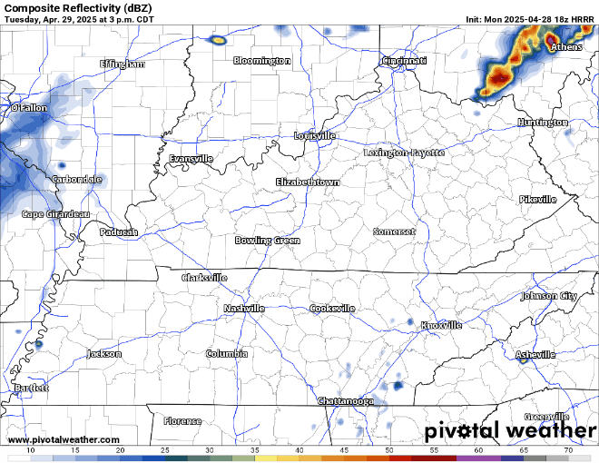
HRRR model, shown below, gives a guess:
More of the same during the same timeframe on Wednesday. Scattered showers/storms possible (~30%) from midday to evening. Storms should remain below severe limits, but some thunder can’t be ruled out.
Thursday has the most likely rain chances – at around 60 – 70%.
Timing again looks to be sometime in the afternoon and evening.
“…we could see a few stronger storms with the front. Large hail and gusty winds would be the main threats.” says NWS Nashville.
Euro model thinks it might look something like this (although it may not!):

And Friday we have our last chance for scattered showers/storm before a dry weekend. Yes, again during the afternoon/evening.
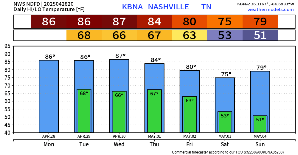
High temps will be in the mid to upper 80s up until Friday, when we cool down a bit as we head into the weekend – perfect timing.
Long-range ensembles think next week looks fairly dry with seasonal temps.
Categories: Featured Blog