


Models have sorta backed off on our rain chances for Monday, Tuesday, and Wednesday – although chances still exist.
HRRR model (amongst others) think we stay dry on Monday. A stray shower can’t be ruled out though.
Chances a tad higher on Tuesday (~30%) during the afternoon/evening hours. Most of the activity is expected to stay to our north, but a few showers/storms are possible. We could see a strong storm during this time, with gusty winds, hail, and lightning being the hazards – not concerned about tornadoes.
FWIW, the HRRR model currently only goes out until 1p on Tuesday but shows us dry until then.
More relatively low rain chances on Wednesday (~30%) starting about midday and lasting thru the afternoon. Don’t think everyone will see rain or a storm.
Thursday will be the day where it’s fairly likely that most everyone will see at least some rain. While we still are not outlooked with any severe probabilities, it’s not out of the question that some storm could be strong, with gusty winds and hail.
While it’s not high-res, I think the GFS (shown below) does a decent job of showing the general idea for how Thursday could go.

Friday afternoon/evening will bring us our last rain chances before the weekend. More scattered, random showers/storms possible.
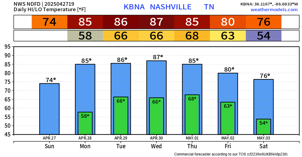
Besides the rain, temperatures will be hot Monday thru Thursday, with highs in the mid to upper 80s. Temps will “cool” off a bit as we head into the weekend.
 Log In To Facebook To Comment