
Although each afternoon/evening will have rain/storm chances thru Friday, chances will gradually increase from today to Thursday, peaking on Friday.
Blanket statement: no severe weather is expected, although you may see a decent thunderstorm one of these days.
Today (Wednesday) will have the lowest rain chances out of the 3. Models think most of the activity stays to our south, but a few showers/storms may creep into our area. Impossible to know exactly who/when – this is almost like a summertime set up. Embrace the uncertainty and cross your fingers if you have a ball game that needs to stay dry.
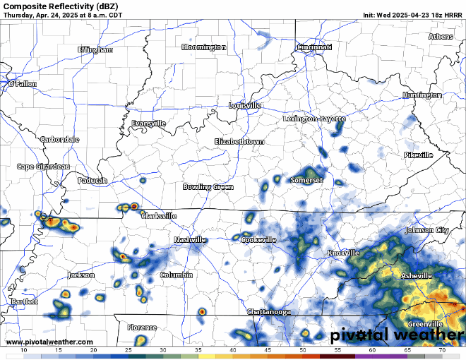
PoPs increase on Thursday. More of the same – random + scattered afternoon/evening showers/thunderstorms.
Radar won’t look exactly like this – but HRRR model gives it a shot below:
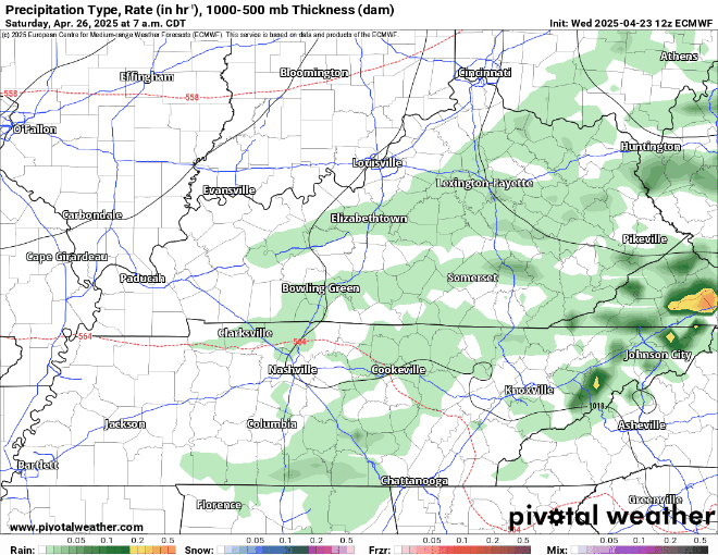
Rain/storms will be most likely Friday afternoon/evening. Think majority of us see at least some precip here, as overall coverage looks widespread.
HRRR only goes out to 1p on Friday for now but goes a good job of showing the thinking on the lots o’ rain. Bad news for ball games, outdoor plans.

I still bring relatively good news for long distance runners, prom goers, and anyone else who plans on being outside Saturday.
Below, shows six different models, all in general agreement that the rain will pretty much be gone by Saturday morning.
Things could change, but so far so good. Confidence will increase as we continue to get closer.
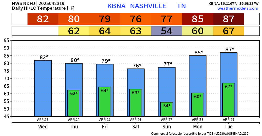
Beginning of next week looks great, dry with increasing temps.
Categories: Featured Blog