


Flooding reports have been common throughout our two counties this morning and will likely continue thru the day. If you see flooding affecting roads and/or structures, please report it with #tspotter.
Many rivers/creeks are running high and out of their banks – be prepared to take action if you live in a flood-prone area.
Our Flood Watch will continue thru 7a Sunday.
The line of storms which trained over both of our counties, prompting us to be live on YouTube for over 7 hours for the entirety of last night has finally lifted north.
While this is good news regarding rain coming to a pause – this is also bad news, since this will allow our atmosphere to destabilize, allowing for additional severe weather chances today.
Threats:
All modes of severe weather will again be possible with this round.
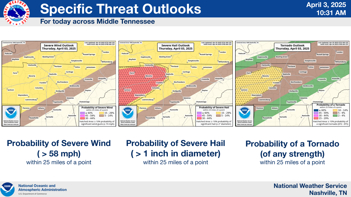
Probabilities of ‘x’ within 25 miles from the SPC are:
- 15 – 30% chance of severe hail (could be 2″+ in diameter, which we saw some yesterday)
- 15% chance of damaging straight-line winds (58 mph+)
- 5 – 10% chance of a tornado (cannot rule out a strong tornado, EF2+)
Timing:
This looks to be an afternoon/evening deal, with severe weather being most likely between 1p and 8p – but still possible outside that timeframe.
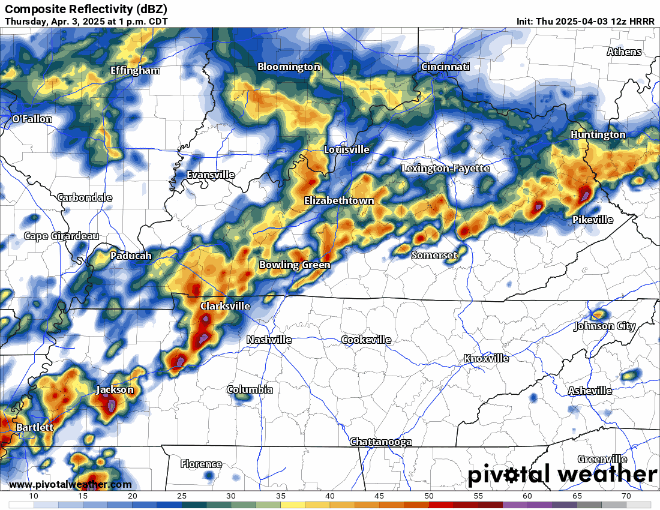
HRRR model thinks it might play out like this – is likely not exactly right, to be used as guidance – not gospel.
Please continue to stay weather aware throughout the day. I know we’ve been fairly busy, but this round deserves attention. Have multiple ways to receive warnings and know where to go if a warning is issued for you.
Rivers/creeks will be more vulnerable to rises due to already saturated grounds. Turn around, don’t drown.
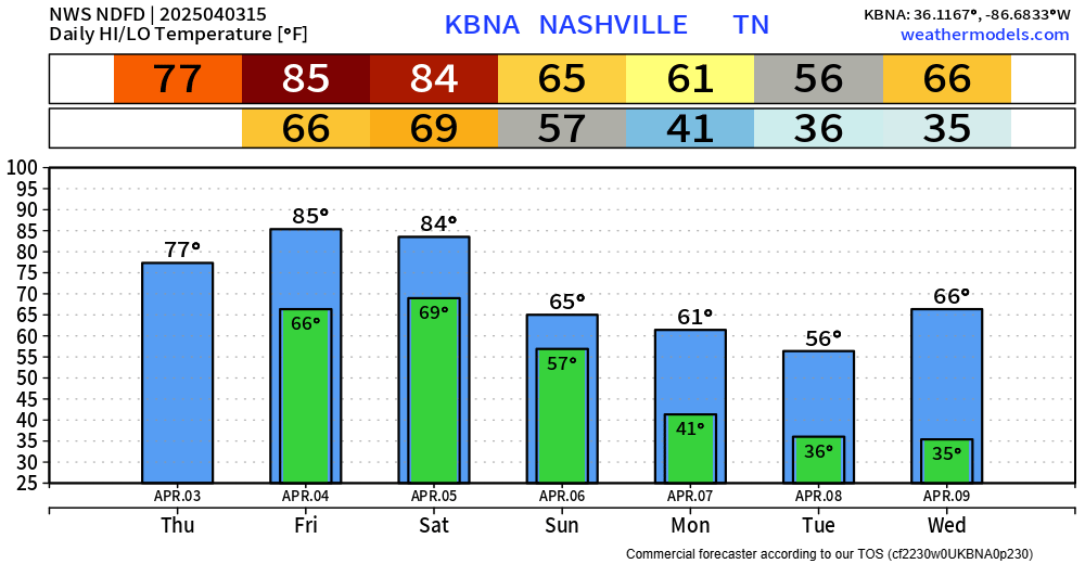
Friday looks like we might see a lull in the action minus a few scattered showers/storms during the afternoon/evening – but these will likely stay below severe limits. Some of us might stay dry.
Saturday will be our last day dealing with severe chances for at least a while. We’re close.
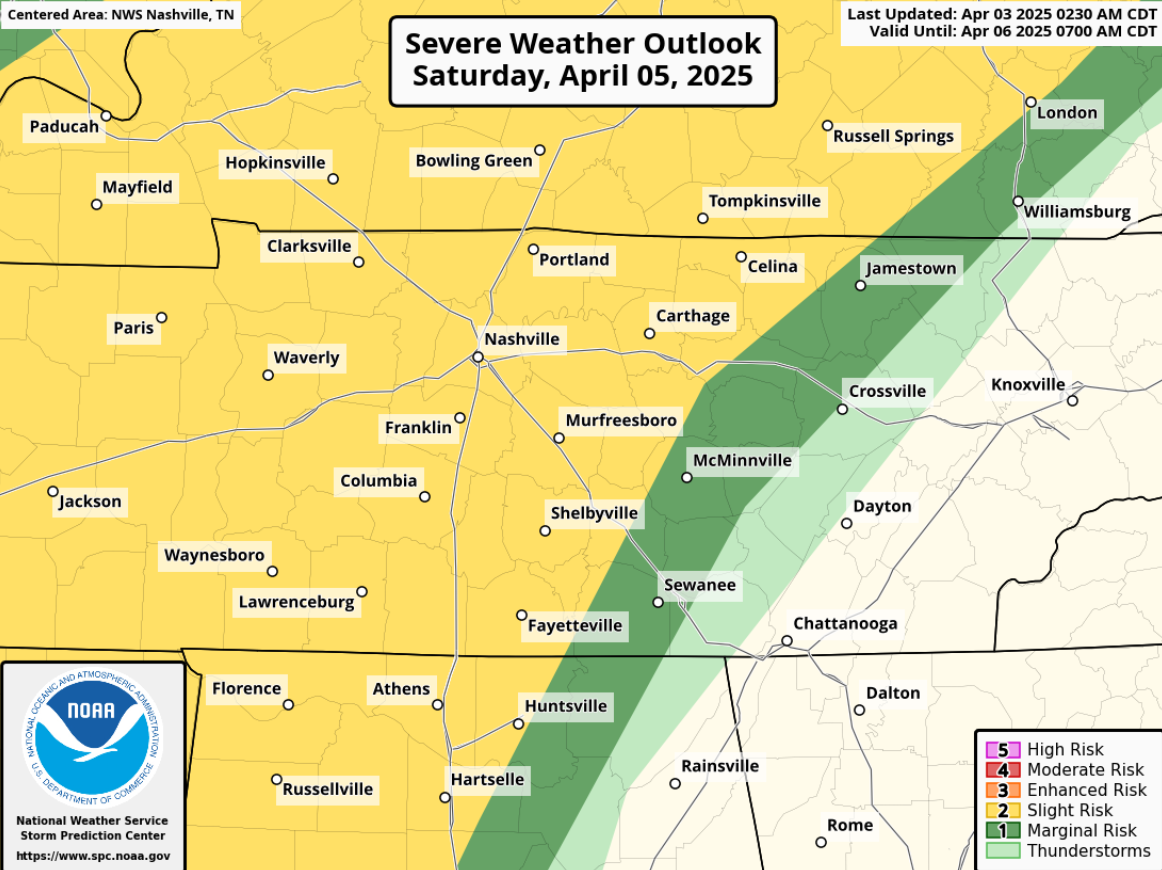
More potential for severe weather + heavy rain will exist. Timing a little uncertain right now, but more likely in the afternoon thru the overnight hours. This will likely get adjusted.
All modes of severe weather will yet again be possible.
Additional heavy rains will again bring the chances for flash flooding and rises on rivers/creeks. Additional rainfall (on top of what has already fallen) likely in the 2 to 5″ range.
Please stay connected for updates. I know it’s been a busy stretch, but we are almost at the end.
End of severe threat will be signaled by the cold front pushing thru – which will bring us cooler and dry weather to start next week. Couple of mornings could be frosty, maybe freeze.
 Log In To Facebook To Comment