
No April Fools jokes here. We are about to enter an active (and very complicated) pattern that will give us the potential for severe weather and flooding everyday Wednesday through Saturday. This does not mean we will see severe weather and flooding every single day – in fact, majority of the days we might not see either. However, the chance will exist.
Lots to read! Lots of uncertainty too, embrace it.
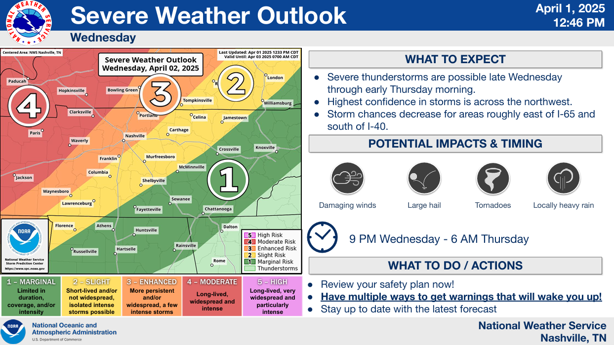
Wednesday Afternoon thru Early Thursday Morning:
This timeframe will have our “highest” severe weather threat over the next several days.

The Storm Prediction Center has outlooked our two counties with the following probabilities of ‘x’ within 25 miles:
- 15-30% of severe hail (1″+)
- 15% chance of damaging straight-line winds (58 mph+)
- 5-10% chance of a tornado
The NW half of our area has higher probs due to higher confidence in storm coverage.
A line of storms is expected to move thru AR/West TN and slowly make its way towards us. The big question is whether or not said line of storms actually makes it this far east.
Another thing we will be watching is the potential for any supercells to form out ahead of the main line. Although models currently don’t expect this, it will be something to watch Wednesday afternoon/evening.
There is a lot of uncertainty on how far east the line of storm makes it before it stalls out.
(These scenarios do not account for any pre-frontal storms, which could be severe).
Scenario #1 – The line of storms stalls to our west, greatly decreasing our chances for any severe weather and/or flooding – we could end up seeing very little to no rain.
Scenario #2 – The line of storms does make it to our area, in which probabilities mentioned above would hold true – also introducing a potential for flooding.
Previous runs of the HRRR model favored scenario #1. However, the latest run (shown below) shows the potential for scenario #2.
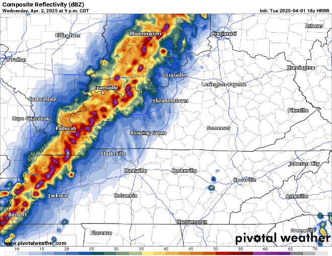
Other models (like the NAM models) favor scenario #1.
Point is, there is a lot of uncertainty. Hopefully models begin to come to some sort of agreement (I’d prefer agreement on Scenario #1) here in the later runs. For now, stay connected and plugged in for updates.
This would be an overnight threat, and you’ll need to have ways to wake up if a warning is issued for you.
Thursday:
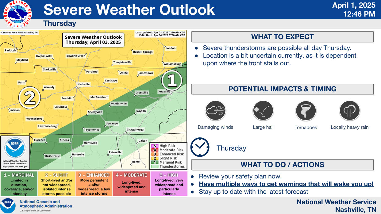
Unfortunately, what happens Thursday greatly depends on what happens overnight Wednesday.
If the line of storms does make it to our two counties, we could be dealing with showers/storms all day – with the potential for flooding and severe weather throughout the day. No thank you.
If we do see storms, we’d deal with a 15% chance of seeing severe weather within 25 miles. Along with a potential for flooding.
But if the line of storms does end up stalling out to our north and west, it’s possible we are mostly dry Thursday.
Friday and Saturday:
And yes, again Friday and Saturday both have chances for severe weather and flooding.
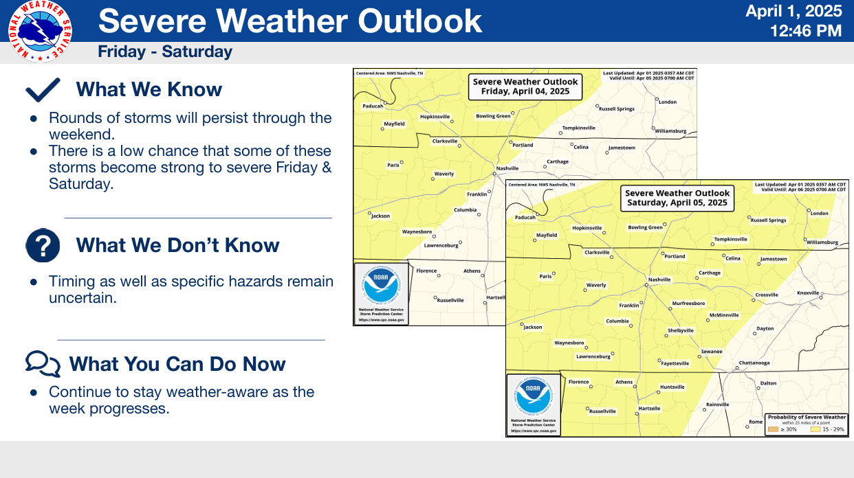
Yet again, the forecast on these days largely depends on where this front stalls out at.
Rain and storms will be possible throughout both days Friday and Saturday. It could rain a lot, it could rain very little.
Wherever the front ends up, it will finally push thru our area sometime Saturday night or Sunday morning. We’ll see some rain and maybe storms along it and then our stretch of weird weather will come to an end.
Flooding:
Both of our counties will be under a Flood Watch from 7p Wednesday thru 7a Sunday.
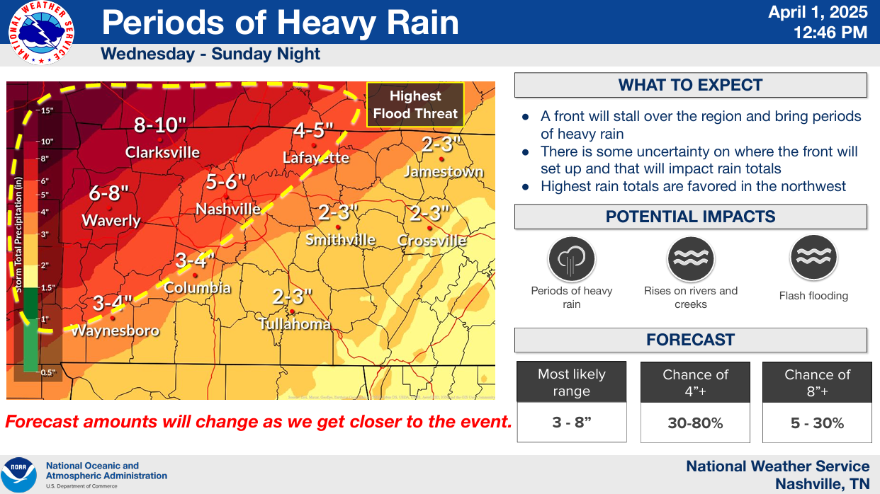
3 – 6″ of rain will be possible during this time, more or less also not out of the question. The axis of heaviest rain is still expected to end up to our NW, but this could change.
Flash flooding, along with rises on rivers and creeks will be possible. If you live in a low-lying or flood prone area, have a flood plan!
Additionally, we’ll be under a Wind Advisory from 10a Wednesday – 4a Thursday.
Non-thunderstorm wind gusts from the south will be blowing at up to 45 mph. Secure any outdoor furniture, trash cans, etc. Travel for high profile vehicles on E-W oriented roads (such as I-40, 840) may be difficult.
Takeaways:
- The forecast could very easily change, please stay connected for updates
- Where the front stalls out will dictate our severe/flooding potential
- Know your plan/have a way to wake up if a warning is issued for you
- Know your flood plan if you live in a flood-prone area
- Good news is that the highest severe weather and flooding chances are to our NW
- Outdoor plans will be in question Wednesday evening thru Sunday morning, having a backup indoor plan is not a bad play

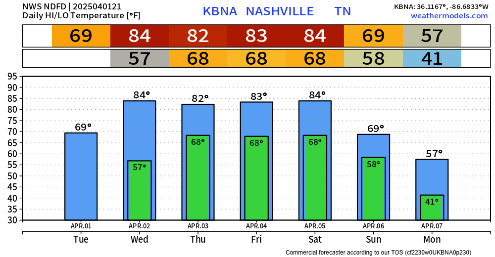
In other news, temps will be hot Wednesday – Saturday with highs in the low to mid 80s. Don’t let these temps fool you, still expecting one more cold snap near the 8th or 9th, which could bring us one more freeze.
Categories: Featured Blog