

We’ll have a small break from the crazy weather for the rest of today and Tuesday.
Two main concerns we’ll be watching for the remainder of the week – severe weather and flooding. Both deserve attention.
Severe Weather Potential: Wednesday & Thursday
We have a conditional threat for severe weather on both of these days, meaning the ingredients needed for severe storms look to be in place – however, it is unsure if there will be enough forcing for storms to form/if storms make it this far east.
As of right now, we have no way of knowing if we do end up getting enough forcing for storms to form or if storms do make it this far east.
This is something that will need to be watched.
The Storm Prediction Center has outlooked both of our counties with a 30% chance of severe weather within 25 miles on Wednesday…
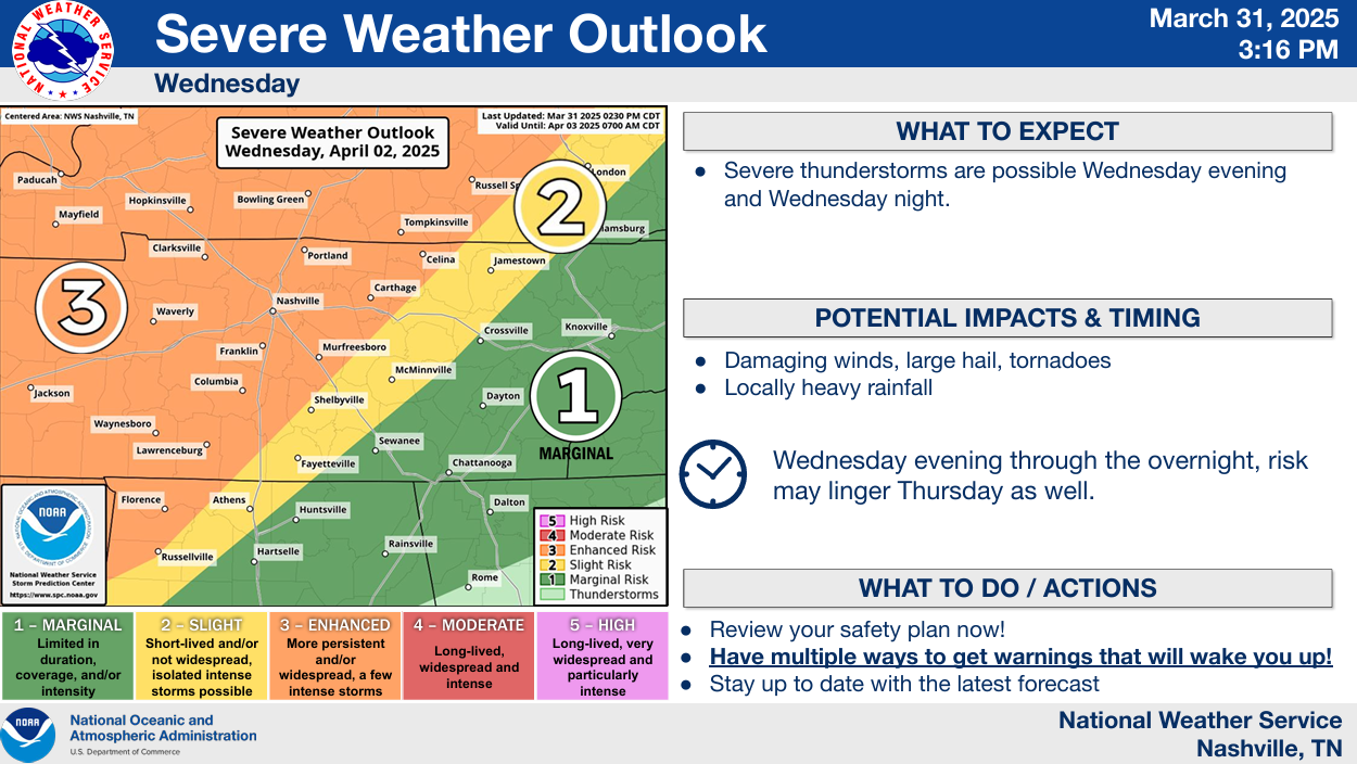
…and a 15% chance of severe weather on Thursday.
If we were to see storms on Wednesday, the timeframe would be evening thru the overnight hours. Probably similar timeframe on Thursday. All modes of severe weather would be possible – damaging straight-line winds, large hail, tornadoes.
There’s still a lot of uncertainty with this. Thankfully, high-res models will be in range soon and will be able to give us a better idea. Stay connected for updates!
Flooding Threat: Wednesday PM – Sunday
The other threat we have to deal with is the potential for flooding.
NWS Nashville has already gone ahead and issued a Flood Watch for both of our counties from Wednesday evening until Sunday morning.
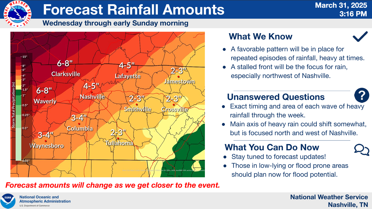
Why: 3 – 5″ of rain will be possible throughout these days from multiple rounds of heavy rain.
When: Exact timing of said rounds of heavy rain is still unknown but – it won’t rain the entire time Wed. – Sun.
Outdoor plans this weekend look questionable. Maybe start thinking of an indoor backup plan.
The axis of heaviest rain is still expected to end up to our northwest, but this could still change.
Those that live in low-lying/flood prone areas should plan now for flooding potential!
Details on both the severe and flooding side of things could change between now and then. Stay plugged in for updates.
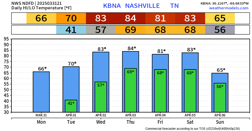
If you haven’t planted already, I’d hold off for now. Models are in pretty good agreement that we see another cold snap around April 8/9. Unsure if we will get below freezing, but better safe than sorry I suppose.
For reference, our average last Spring freeze is actually today, March 31.
And to cap it all off, we’ll string together several days of 80°+ this week, Wednesday – Saturday.
Categories: Featured Blog