

Please stay weather aware thru early Monday morning.
We are continuing to watch the threat for severe weather from late this afternoon thru early Monday morning.

The Storm Prediction Center has us outlooked with the following probabilities of ‘x’ within 25 miles:
- 45% chance of damaging straight-line winds (58 mph+)
- 15% chance of hail (1″+)
- 10% chance of a tornado (could be strong, EF2+)
These probabilities are valid for both potential rounds of severe weather.
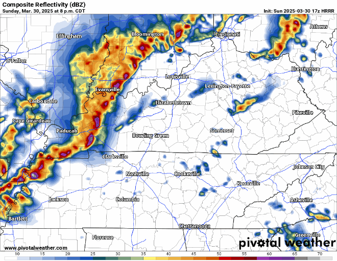
Late Afternoon/Evening:
While still relatively unlikely, some isolated supercells cannot be ruled out this afternoon/evening. *If* these cells do form, they will certainly be worth watching. All hazards would be possible with these including damaging straight-line winds, hail (could be large), and a tornado or two (could be strong, EF2+).
This will largely depend on if our atmosphere is “capped” or not, AKA if there is a layer of warm, stable air aloft – which would prevent storms from becoming strong.
We’ll be watching the radar all day and will post any updates on all of our socials. Please stay connected throughout the day.
Even if we do see showers/storms this afternoon/evening, our severe threat tonight will still exist.
Late Evening/Overnight Tonight:
This will be our more widespread severe weather concern.
A line of storms is expected to move thru our area sometime between 10p Sunday and 2a Monday. The main focus with this line will be the threat for damaging straight-line winds, but a tornado or two is also possible.
What To Do/Preparing:
Stay connected and plugged in for updates. Keep your devices charged in case the power goes out.
Have multiple ways to receive warnings. NOAA Weather Radio, Wireless Emergency Alerts on your phone (make sure they are ON and your DND is OFF), wake-me-up apps are all good.
Check back in with the forecast before you go to bed and have ways to wake up if a warning is issued for you.
❌Do not rely on sirens to wake you up.❌
Know where your safe place is. Mobile homes are not safe places to ride out severe weather in.
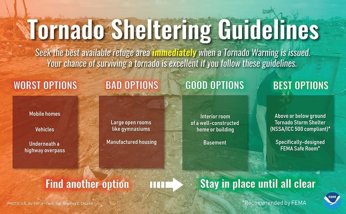
We will go live on our YouTube channel if a warning is issued for any portion of our two counties.
Stay connected and informed!
We should be dry by Monday morning and will be left with dry and cooler weather thru Tuesday.
Wednesday and Thursday both our counties are outlooked for severe weather potential, with Wednesday probably being the main concern.
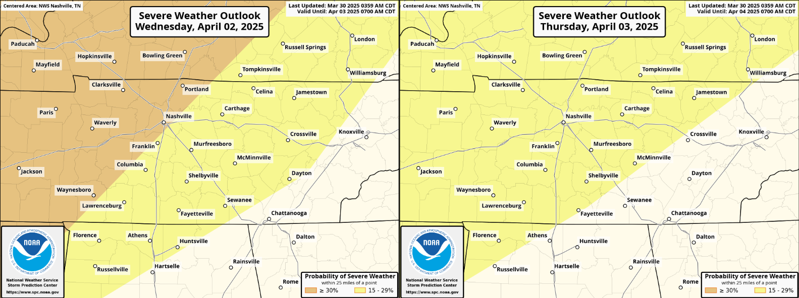
All modes of severe weather will again be possible. Still, lots of questions on timing and threat specifics, which will become clearer in the coming days. Stay connected. More deets on this tomorrow.
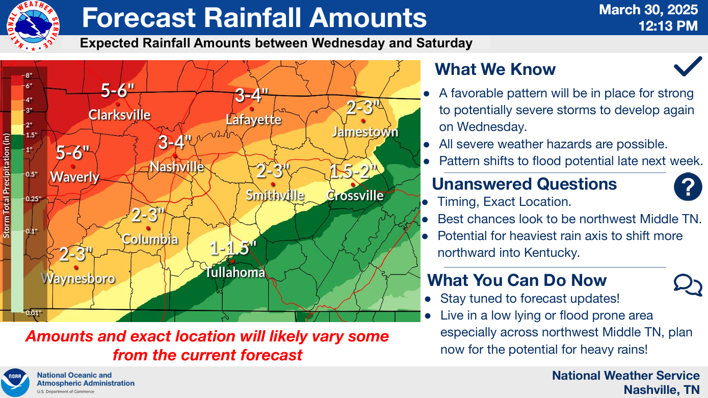
Several rounds of potentially heavy rain will be possible mid to late this week. Rainfall totals could add up and we could deal with some flooding concerns.
For now, the axis of heaviest rain is expected to be to our northwest – but this will have to be carefully watched, particularly if you live in a flood prone area.
None of this information is meant to scare you, just to keep you informed. Springtime is usually our busiest in regard to severe weather. We have a great article here on storm anxiety: Taking Care of Storm Anxiety | Nashville Severe Weather
Also, if you haven’t planted yet – I’d hold off. Models show cold air inbound in ~10 days.
Categories: Featured Blog