
Scattered rain will continue to move thru the area for the remainder of today (Saturday). Rain gear a good idea as you walk out the door for your evening plans.
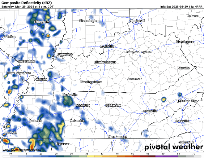
You can check the radar anytime on our website here: Radar | Nashville Severe Weather
Main focus is our severe weather threat for overnight Sunday.
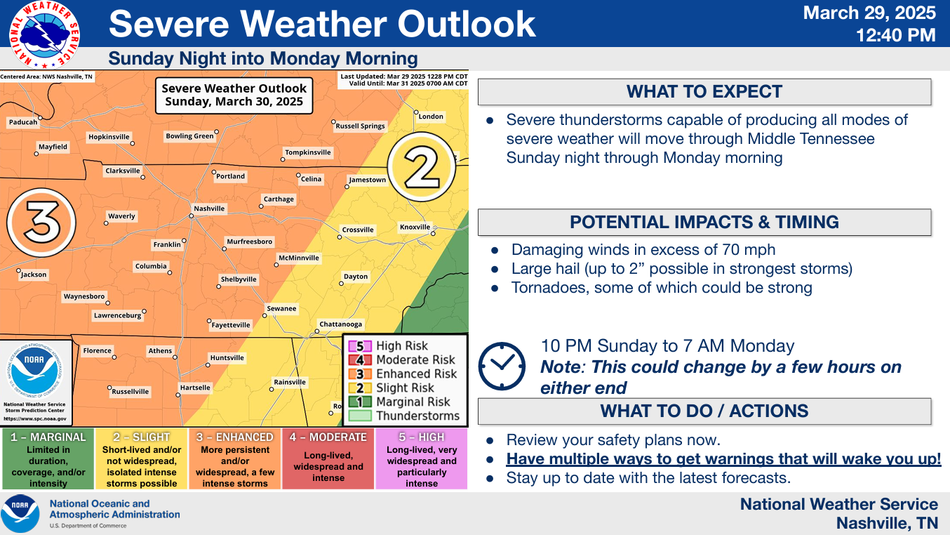
The Storm Prediction Center has our counties outlooked with the following probabilities of ‘x’ within 25 miles:
- 30% chance of damaging straight-line winds (some gusts could be > 74mph).
- 15% chance of severe hail (1″+)
- 10% chance of a tornado (cannot rule out a strong tornado, EF2+)
Timing:
Thinking on timing generally remains the same.
Most likely ETA range is 11p Sunday – 4a Monday.
Sunday during the day should be mostly dry.
Impacts:
The “main show” is expected to be a line of thunderstorm, possibly severe, moving thru the area sometime during said ETA range. The most likely hazards will be damaging straight-line winds and possibly an embedded tornado or two.
Another thing we’ll have to watch is the possibility of any supercells forming ahead of the main line. These would certainly have our attention, and all modes of severe weather would be possible with these. While this is currently unlikely, it’s something worth watching.
HRRR model gives a guess below – to be used as guidance, not gospel.
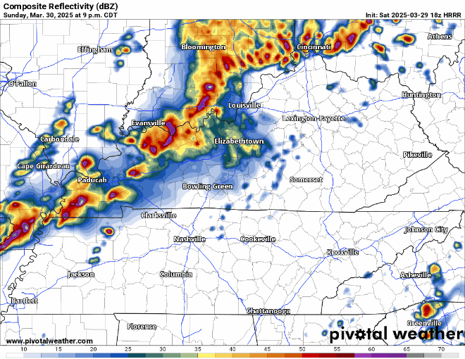
Once that line moves thru sometime early Monday morning, our severe threat will be over – until Wednesday.
Preparing/What To Do:
The time to start preparing is now.
With the threat being overnight, it just makes it that much more dangerous.
You need to have multiple ways to wake-up if a warning is issued for you.
- NOAA Weather Radio
- Wireless Emergency Alerts on your phone (make sure they are ON)
- Wake-me-up app
❌Do *not* rely on sirens to wake you up.❌
✅This is a nice checklist to go through before now and the time you go to sleep Sunday night.

The forecast could change, stay connected and plugged in for updates! We’ll be posting updates on all of our socials between now and then. We’ll get thru this just fine.
We should dry out by mid-morning on Monday. Temps will (briefly) be cooler and we’ll be dry thru Tuesday.
And as soon as the severe threat ends early Monday morning, we’ll immediately turn our focus towards our severe chances on Wednesday.
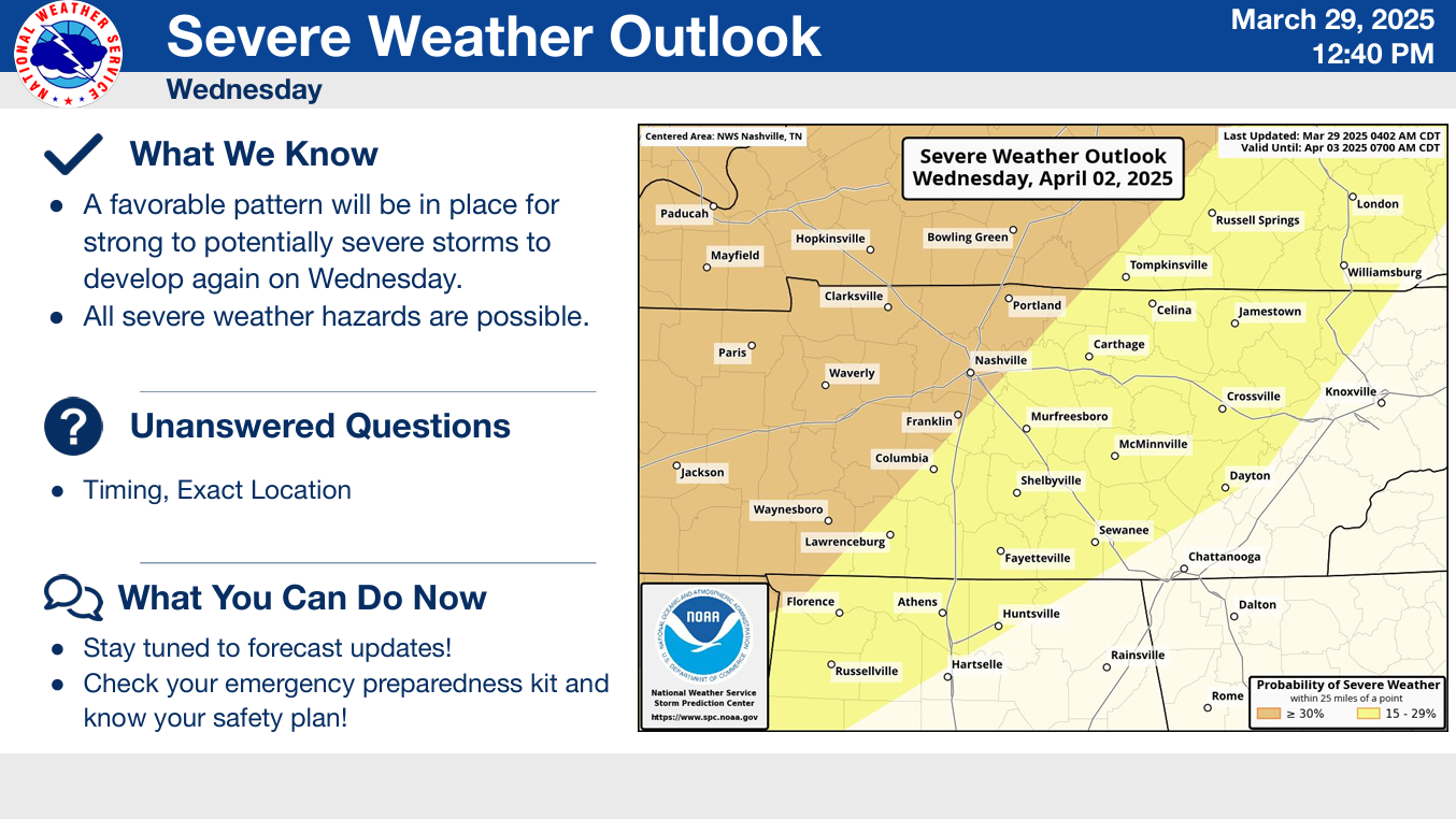
The Storm Prediction Center has our two counties under a 15-30% chance of severe weather within 25 miles. Try not to focus on exactly where the lines are drawn – this will likely change several times between now and Wednesday. Still plenty of questions surrounding this threat but will certainly have to be watched.
We’ll have several rain chances from mid to late next week, and unfortunately, the rain totals could pile up.
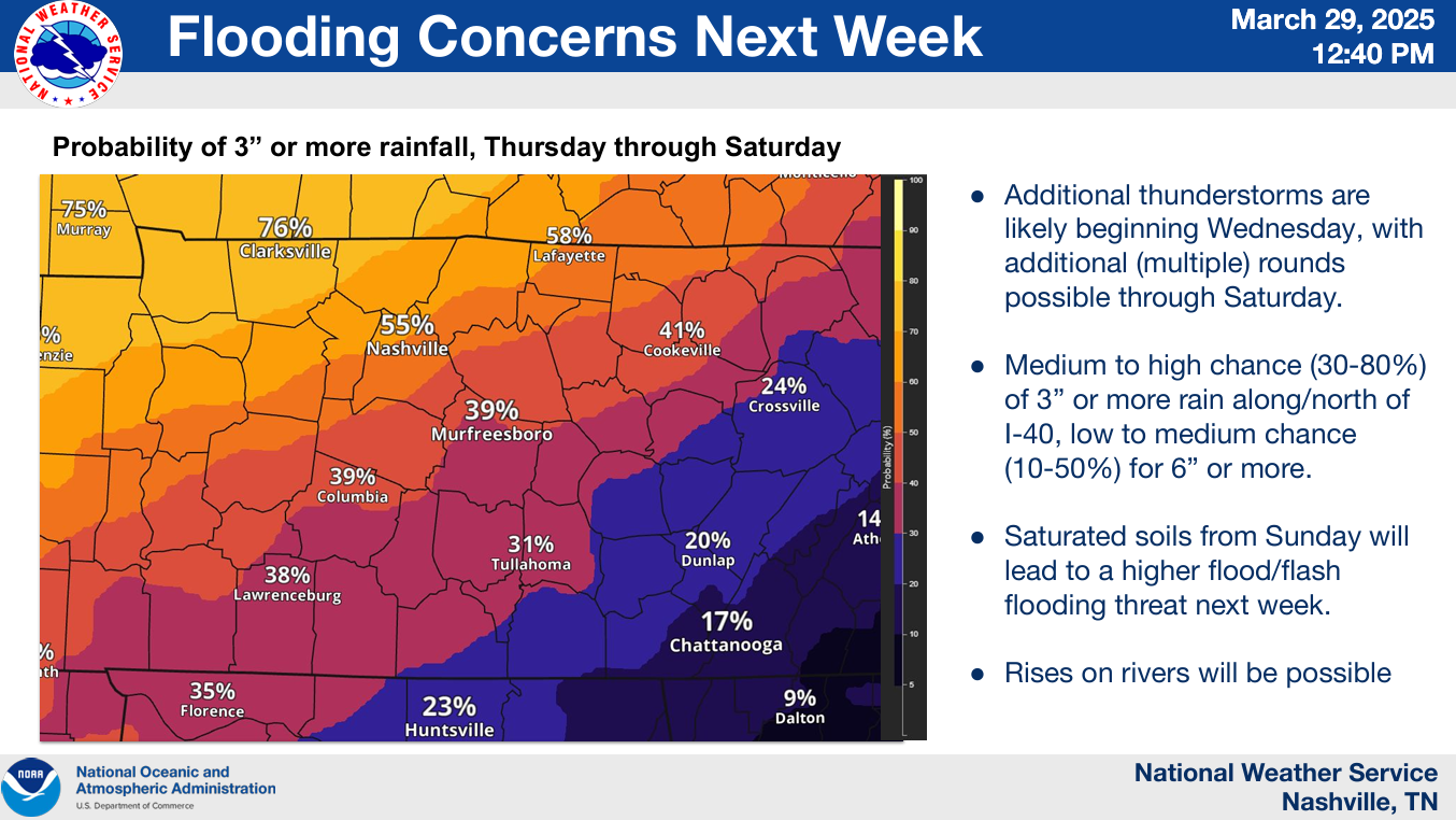
While the highest chances of 3″+ are currently to our NW, this could shift. While we’re a ways out, this is something to watch, especially if you live in a flood-prone area.
It’s certainly Springtime. Stay connected and weather aware!
Spring in Middle TN is typically our most active severe-weather wise – which can cause anxiety levels to creep up. We have an article here on storm anxiety: Taking Care of Storm Anxiety | Nashville Severe Weather
Categories: Featured Blog