
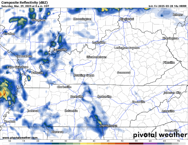
Showers and non-severe storms will be possible Saturday (50-60%), especially during the second half of the day.
HRRR model gives a guess below, looping thru Sat. morning thru the end of the day. Rain gear not a bad idea for any afternoon/evening plans.
Radar won’t look exactly like this but can give a decent idea of how things might play out.
Sunday, severe weather has become increasingly likely – particularly from Sunday evening thru the overnight hours.
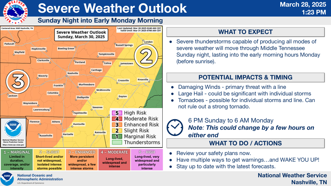
The Storm Prediction Center has increased our probability of severe weather occurring within 25 miles of any given location to 30%, with at least a 10% chance of significant severe weather.
Storm mode will dictate what our main threats would be.
If we see isolated cells (supercells), all modes of severe weather would be possible (damaging straight-line winds, hail, and tornadoes).
If the storms arrive in more of a line, then the damaging straight-line wind threat would be the main concern, with embedded tornadoes possible.
Timing has low to medium confidence.
Right now, a rough ETA would be from 9p Sunday – 3a Monday. This is subject to change as models don’t have the best grasp on it right now. Don’t be surprised if this changes a bit.
We are close to being in range for all of the high-res models to start giving their guesses – the more data we have to look at, the better.
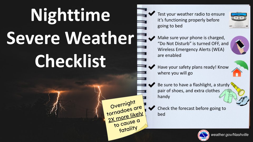
Stay connected from now thru early Monday morning. We’ll keep y’all posted on all the latest updates.
With this being a mostly overnight threat, now is a great time to begin thinking about your nighttime severe weather plan.
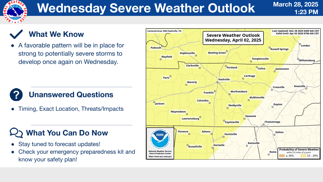
We should be clear by late Monday morning and will have a break from the busy weather until Wednesday.
Once again, we will be watching the potential for severe weather on Wednesday.
This is still a ways out and lots will change, but something to watch, especially after we get thru Sunday.
Categories: Featured Blog