
Friday gives us one last day of nice weather until our relatively active weekend. Some of us may reach 80°.
Saturday looks rainy at times, especially the second half of the day. No severe weather expected.
HRRR model only goes out until 1p on Saturday (for now) but gives us a guess at what the first half of the day might look like.
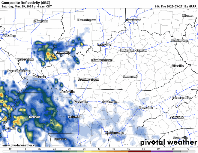
Scattered showers/storms will be possible thru the afternoon/evening, but it won’t be a constant rain. Forecast subject to change.
We are still watching the potential for severe weather on Sunday, afternoon thru the night.
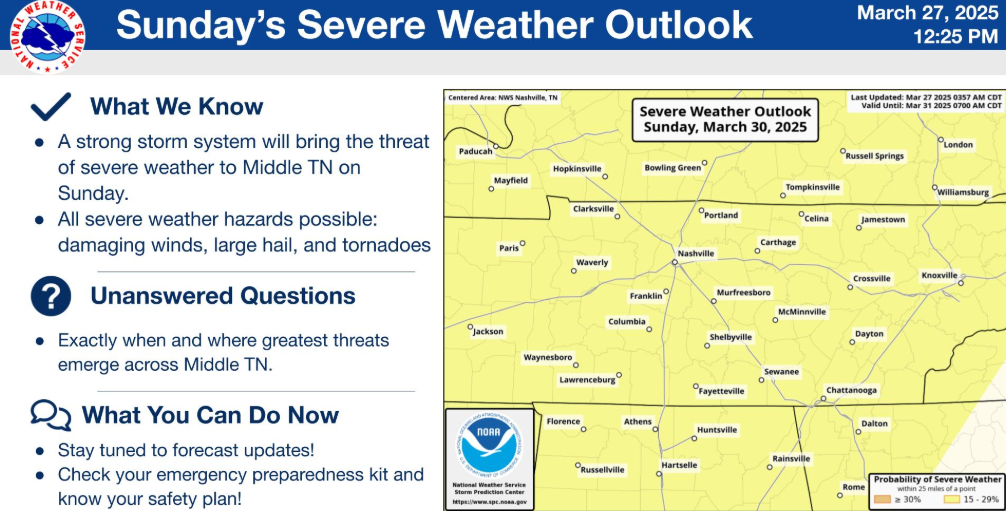
The Storm Prediction Center still has both our counties well within a 15% chance of severe weather within 25 miles.
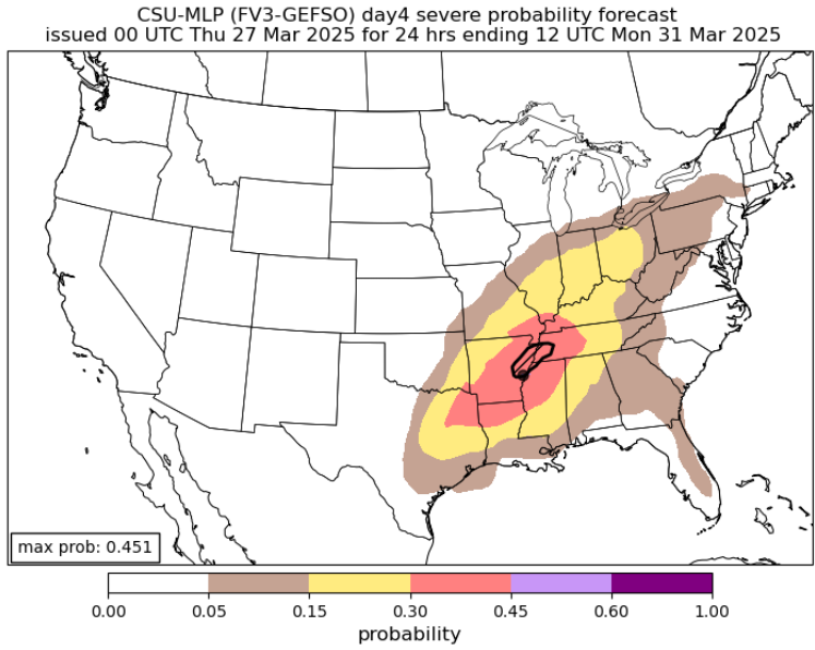
If you are curious, the unofficial (but still respected and useful tool) CSU MLP output also still has us in the 15% probs, with higher probs to our west.
All modes of severe weather look possible, including damaging straight-line winds, hail, and tornadoes. We won’t get the probabilities for individual hazards until the SPC releases their Day 2 outlook (on Saturday).
Timing still looks iffy. Models have slowly been pushing back the arrival of storms, so for now a super rough estimate would be Sunday afternoon – early Monday morning.
Stay connected for updates and changes over the next several days!
We’ll dry out at some point Monday morning, and cooler temps will briefly settle in.
Rain and maybe storm chances return by Wednesday.
Longer range models hinting at plenty of rain chances mid to late next week, something to watch after we get past Sunday.
Categories: Featured Blog