
Besides maybe a quick shower Thursday afternoon (although these chances are low, ~15%), the rest of the work week does indeed look dry. Warm temps as well.
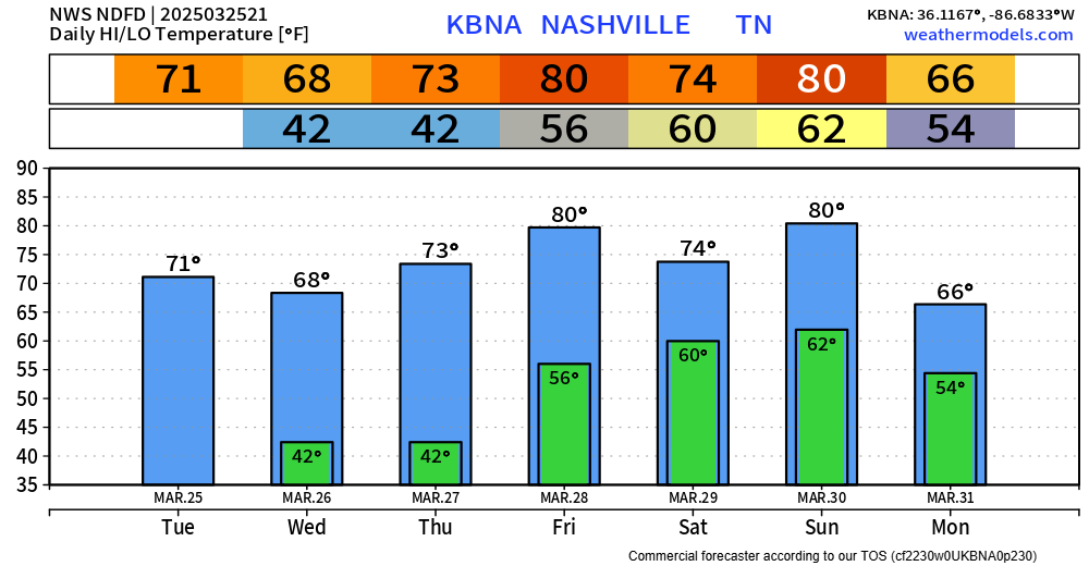
And like clockwork, our rain chances go up as soon as the weekend comes.
We’ll have “low to medium” shower and storm chances on Saturday and Saturday night. No severe weather concerns with this round. Too far out to nail down any specific ETAs.
On Sunday we are still watching the threat for strong to severe storms.
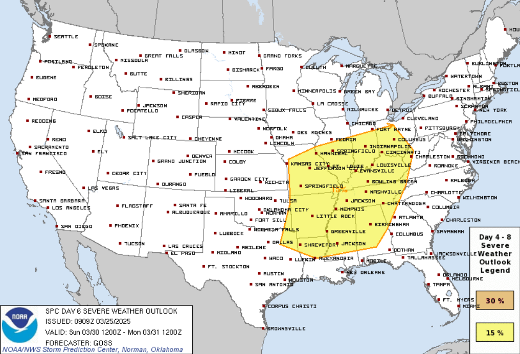
The Storm Prediction Center still has a large area outlooked with a 15% chance of severe weather occurring within 25 miles, including most of Tennessee.
There are still more questions than answers for this event, including specifics on timing, severity, impacts, etc.
“So, with all of this said, there are still a lot of uncertainties regarding this event and the primary hazards, but the overall setup is conducive for severe storms in Middle Tennessee.” says NWS Nashville.
Bottom-line, stay connected to the forecast. Outdoor plans this weekend, particularly those on Sunday, may need an indoor backup.
The question was asked since we are already outlooked this far out, does this mean that the threat will be worse. This is a great question! The answer: not necessarily.
Being outlooked this far out mostly has to do with the overall pattern being supportive of severe weather. 5/6/7 days out, the severity of the event is nearly impossible to predict. This is more of a confidence thing.
With the peak of our severe weather season approaching, a great way to receive warnings is thru a NOAA Weather Radio.
Our weather will calm down Monday.
“Once the front clears the area on Monday, a cooler and more benign pattern will settle in for the beginning of the work week.” good news from NWS Nashville.
Categories: Featured Blog