


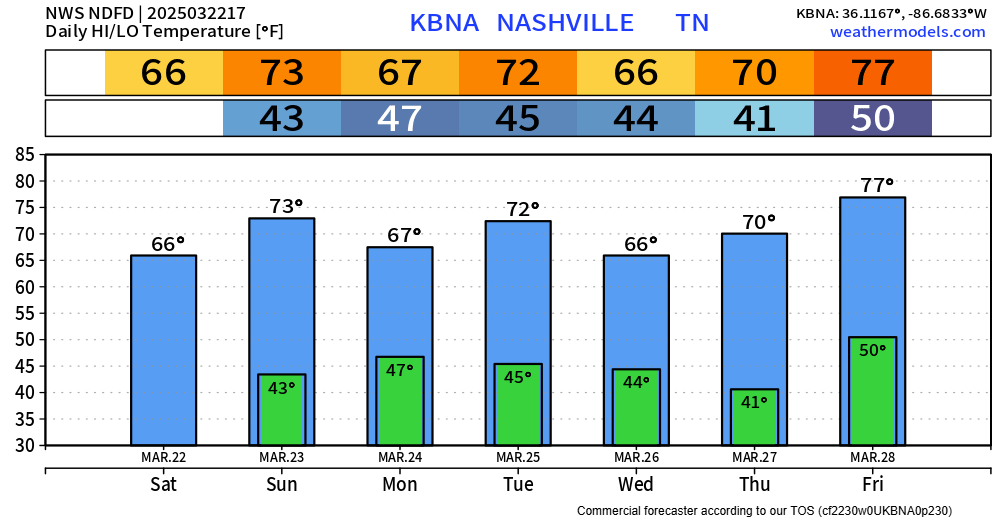
Any outdoor plans now thru midday Sunday look great. Warm temps + dry.
While storms are likely Sunday evening, most of them are expected to stay behaved. But a few may be worth keeping an eye on.
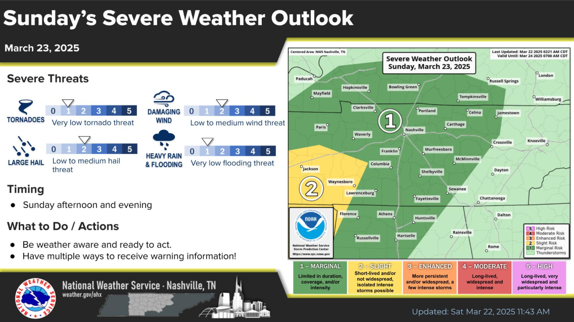
The Storm Prediction Center has our counties outlooked with a:
- 5% chance of damaging straight-line winds and/or hail within 25 miles
- 2% chance of a tornado within 25 miles
Timing:
Most models are in agreement that this is a Sunday late afternoon/evening deal.
HRRR model gives its’ best guess below – to be used as guidance, not gospel.
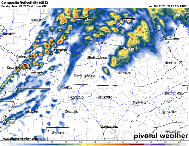
Main “show” will probably be a line that moves thru late Sunday evening, with maybe some storms out in front of it.
Again, overall severe threat is quite low – but worth keeping an eye on. We’ll be watching and sending out updates on all of our socials as needed and will go live on our YouTube *if* a warning is issued for any part of our two counties.
After Sunday, the work week looks dry + warm. Next rain chances maybe next weekend, but way too far out to know any specifics.
 Log In To Facebook To Comment