
It’s quite fitting for the first ‘official’ day of Spring to be cold, cloudy, and some of us even saw some sleet/graupel.
Most, if not all, of us will get down to freezing tonight – cover up any loved plants!
For reference, our average last Spring freeze is March 31. While I can’t make any promises, long range models show no more chances at freezing thru April 4th. Granted, this is all two weeks out – so things could certainly change. The saying goes wait to plant anything until after tax season. It’s definitely the safe play.
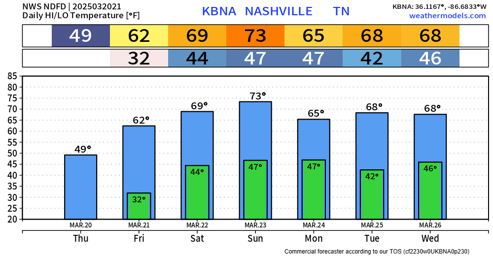
Fortunately, we’ll warm right back up and stay fairly warm thru the next week or so. Friday and especially Saturday during the day will be nice for outdoor activities.
No rain chances until Sunday, when we could deal with some strong to severe storms.
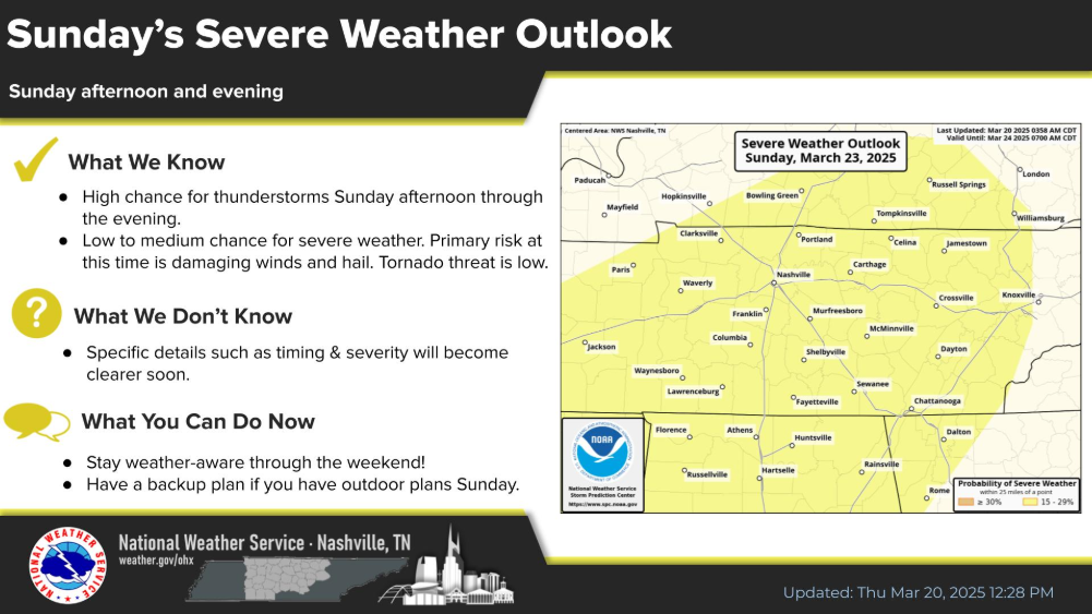
The Storm Prediction Center does have both of our counties, along with the rest of Middle TN outlooked with a 15% chance of severe weather within 25 miles.
Right now, this looks to be a Sunday afternoon and evening deal, with the main threat being damaging straight-line wind threat. Models are not showing the necessary ingredients for any tornado concerns, as of right now.
We are still several days out, so things can change between now and then. Anxiety level is next to none right now. Just something to keep an eye on, especially if you have outdoor plans on Sunday.
After Sunday, our weather looks dry + temps will be fairly seasonal.
Categories: Featured Blog