
Until 10p tonight we will have a Wind Advisory for wind gusts up to 45 mph possible. With winds coming out of the south, travel on W-E roads (like I-40 and 840) may be difficult, especially for high-profile vehicles. Winds should relax tonight.
While our chances for rain tonight are pretty decent (~60%), our chances of seeing any damaging straight-line winds and/or hail are a mere 5% within 25 miles. We are not included in any tornado probabilities.
ETAs for “main” line of storms are ~8-10p tonight, with a few showers out ahead possible.
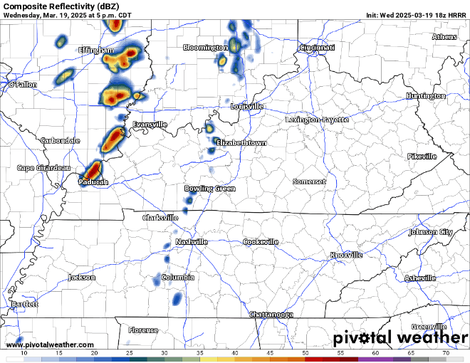
Temperatures will cool down quite a bit with the passage of the cold front.
We may see some sprinkles, or maybe a flurry or two Thursday AM, but no accumulation as ground temps will be well above freezing.
Temps only making it to the upper 40s, maybe 50° on Thursday, but start to warm back up for the weekend.
Starting to return to that time of year when a freeze is worth noting. Most of us will likely end up a tad below freezing Friday AM – cover up any plants! No other freezes in the upcoming forecast but can’t promise it’ll be the last.
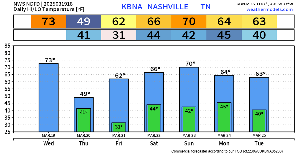
High (~80%) rain chances return Sunday. Looks like the threat for severe weather will stay to our SW but still keeping an eye on it.
Categories: Featured Blog