
Another seasonally warm day is on tap for Wednesday – highs getting all the way up into the mid 70s – roughly 15° above average.
Part of the reason for the warm temps will be strong southerly winds, gusting up to 45 mph. This is the reason for our Wind Advisory valid tomorrow (Wednesday) from 10a to 10p. With the winds coming out of the south, travel on W-E oriented roads (such as I-40, 840) may be difficult for high-profile vehicles. Secure any outdoor furniture and bring in trash cans.
Along with the gusty winds, before the rain/storm chances, relative humidity values will be a tad low. Combine those two, and our fire danger looks a tad elevated. Be extra cautious with any outdoor burning.
Not many changes to our very low-end threat for straight-line winds and maybe some small hail Wednesday evening.
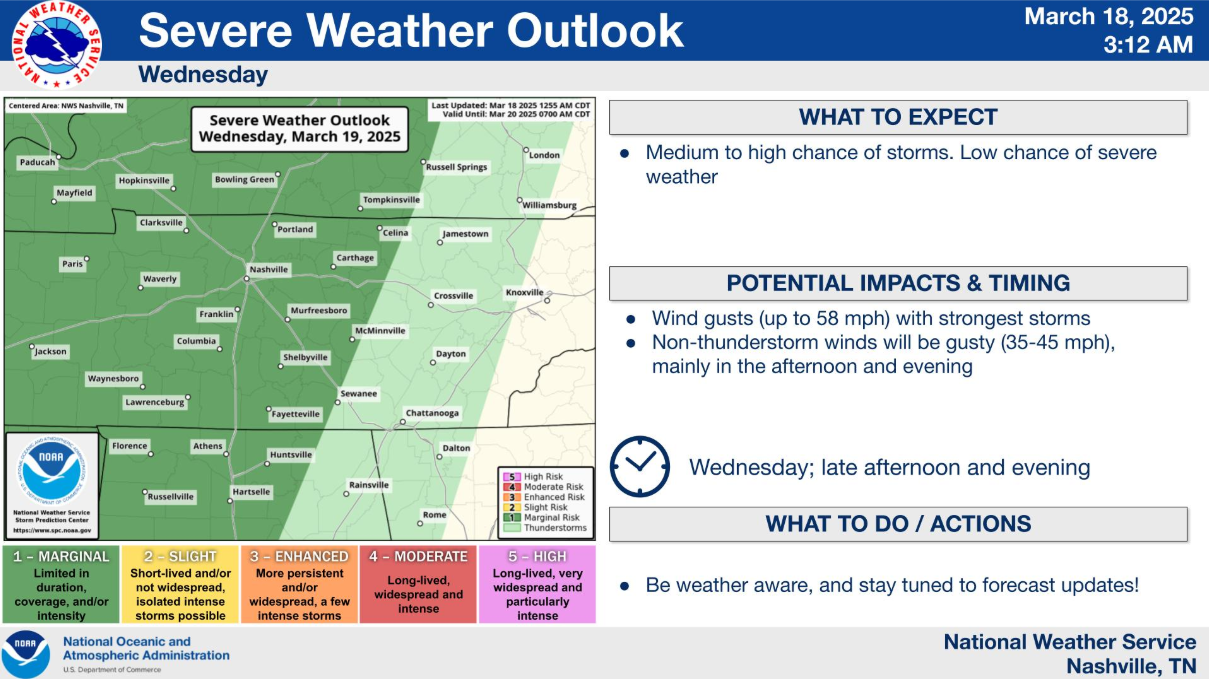
The Storm Prediction Center continues to have both of our counties outlooked with a 5% chance of damaging straight-line winds and/or hail within 25 miles of any given location. We are not included in any tornado probabilities.
A cold front will be the culprit for our rain/storm chances tomorrow. HRRR model shows how things could play out.
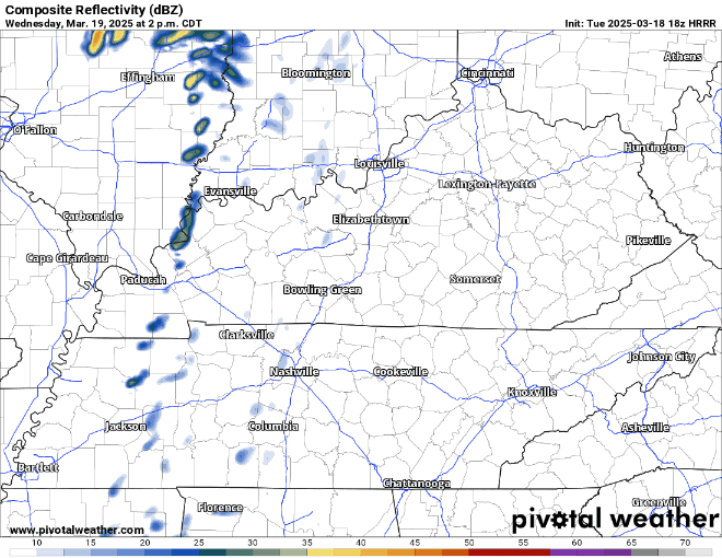
This particular run gives us a rough ETA of ~5-9p. This will likely be changed between now and then. Check back in for updates.
The aforementioned cold front will knock our temps down a good bit. We’ll wake up with temps in the upper 30s on Thursday morning. We could see some wrap-around moisture squeeze out some sprinkles, maybe even a flurry or two if the air aloft is cold enough, but certainly no accumulation.
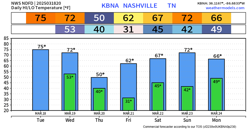
Highs Thursday will struggle to make it to 50°. Most of us will likely make it below freezing Friday AM, although probably not for long. Cover up any loved plants.
We warm right back up for the weekend. Rain chances return Sunday. We are still excluded from any severe probabilities but still keeping an eye on it.
Categories: Featured Blog