
We’ll wake up with temps in the upper 30s/low 40s on Tuesday but quickly get up into the mid 70s by the afternoon.
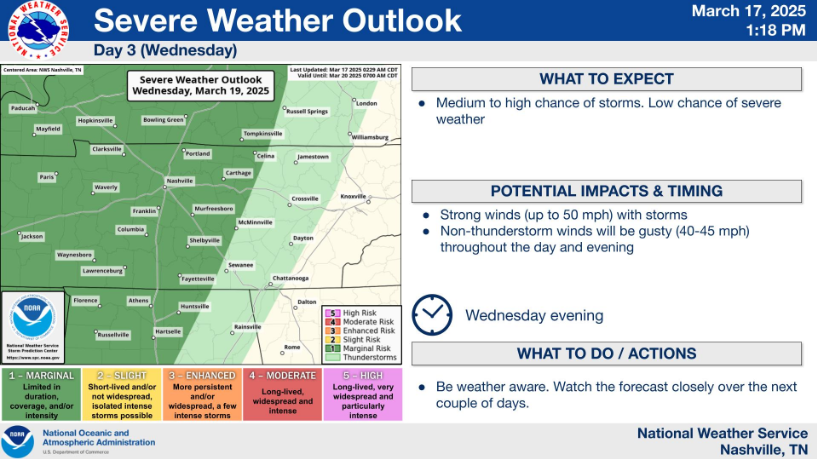
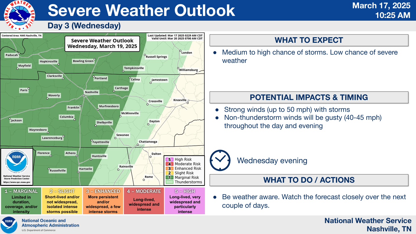
Similar temps for Wednesday, but with chances for some showers/storms as a cold front pushes thru sometime in the afternoon/evening. Before, the rain, wind gusts up to 40 – 45 mph will be possible throughout the day – a Wind Advisory may be needed.
While rain chances are ~70%, our chance for any severe weather is only ~5% within 25 miles, per the Storm Prediction Center.
Shear, instability (storm fuel), and even moisture all look pretty lack-luster at the moment. This looks like a low-end potential for some damaging straight-line winds – not seeing the necessary ingredients for hail or tornado worries. We’ll keep an eye on it tho.
Said cold front will knock temps down for Thursday, but those quickly recover as we get into the weekend.
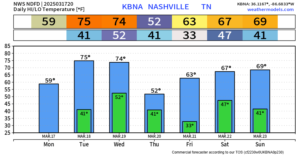
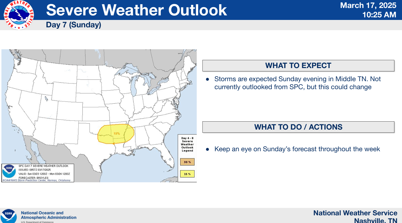
Dry Thursday-Saturday before rain/storm chances return Sunday.
While we are excluded from any severe probabilities for Sunday, they do exist not too far to our SW. Again, something to keep an eye on.
Categories: Featured Blog