
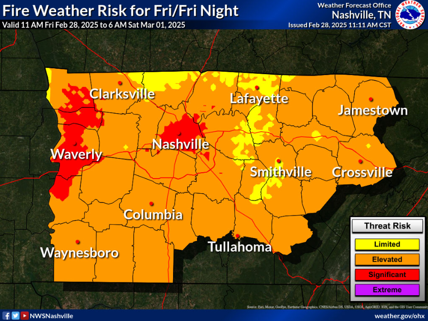
With warm temps, low relative humidity, and gusty winds today – some elevated fire danger will exist. Under these conditions, fire can spread quickly. Outdoor burning is discouraged.
Jumping ahead to Tuesday.
We are still outlooked with a 15% chance of severe weather within 25 miles by the Storm Prediction Center. This outlook will likely change multiple times between now and Tuesday.
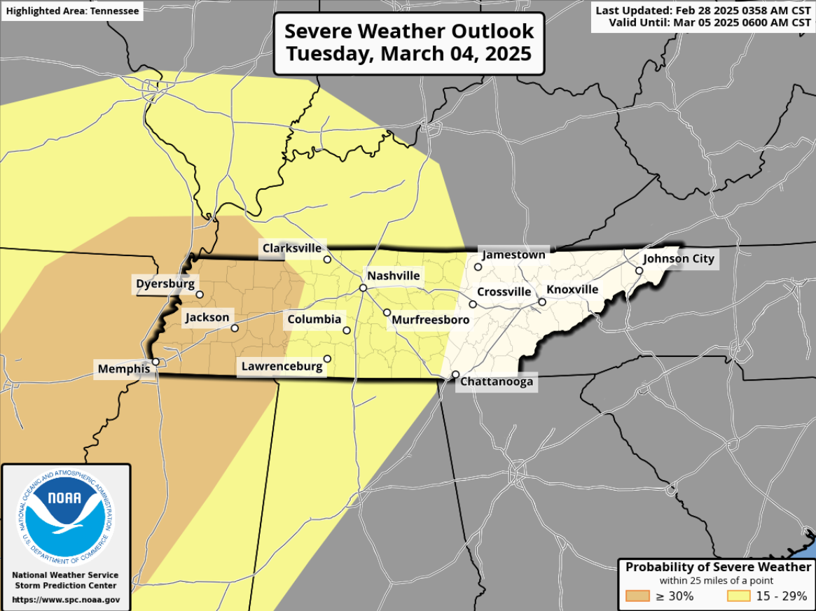
There is still a lot of uncertainty with this.
“With this very dynamic system, wind shear isn’t a question. But as previous discussions have mentioned, the moisture is. Dewpoints ahead of this system are expected to remain in the 40s with no strong moisture advection to help build the necessary moisture and instability. This continues to be our limiting factor.” – from the genius minds at NWS Nashville
As it always seems, wind shear will be present, however the moisture/instability (storm fuel) appears to be lackluster as of right now. This of course, could change, but for now the numbers displayed by the GFS/Euro ensembles are not worrisome for us.
This will have to be watched, as we are still several days away and haven’t gotten in range for the high-resolution models yet. Continue to stay connected for updates!
In other news, this weekend looks dry + cool.

Low rain chances (20 – 30%) exist Monday afternoon + evening as we could see some quick showers. NBD.
Regardless of intensity, we’ll at least see some rain on Tuesday, more likely in the evening/nighttime.
Next week looks cool + dry after Tuesday’s system exits.
Categories: Featured Blog