
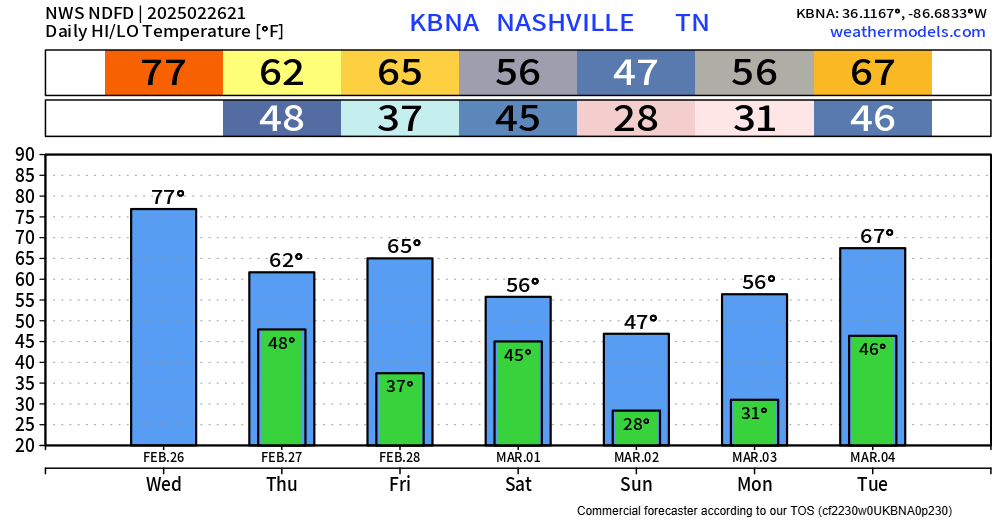
We yet again blew past our forecasted high, getting all the way up to 80° – breaking our old daily record high of 79° set back in 1917.
Some of us may see a quick shower during the early early morning hours of Thursday. “Highest” chances are in N. Davidson Co. (ofc Joelton), but even those chances are still quite low.

We begin our ride down on the coaster starting Thursday but really drop Sunday. We’ll see temps below freezing again – but only briefly as temps climb right back Tuesday.
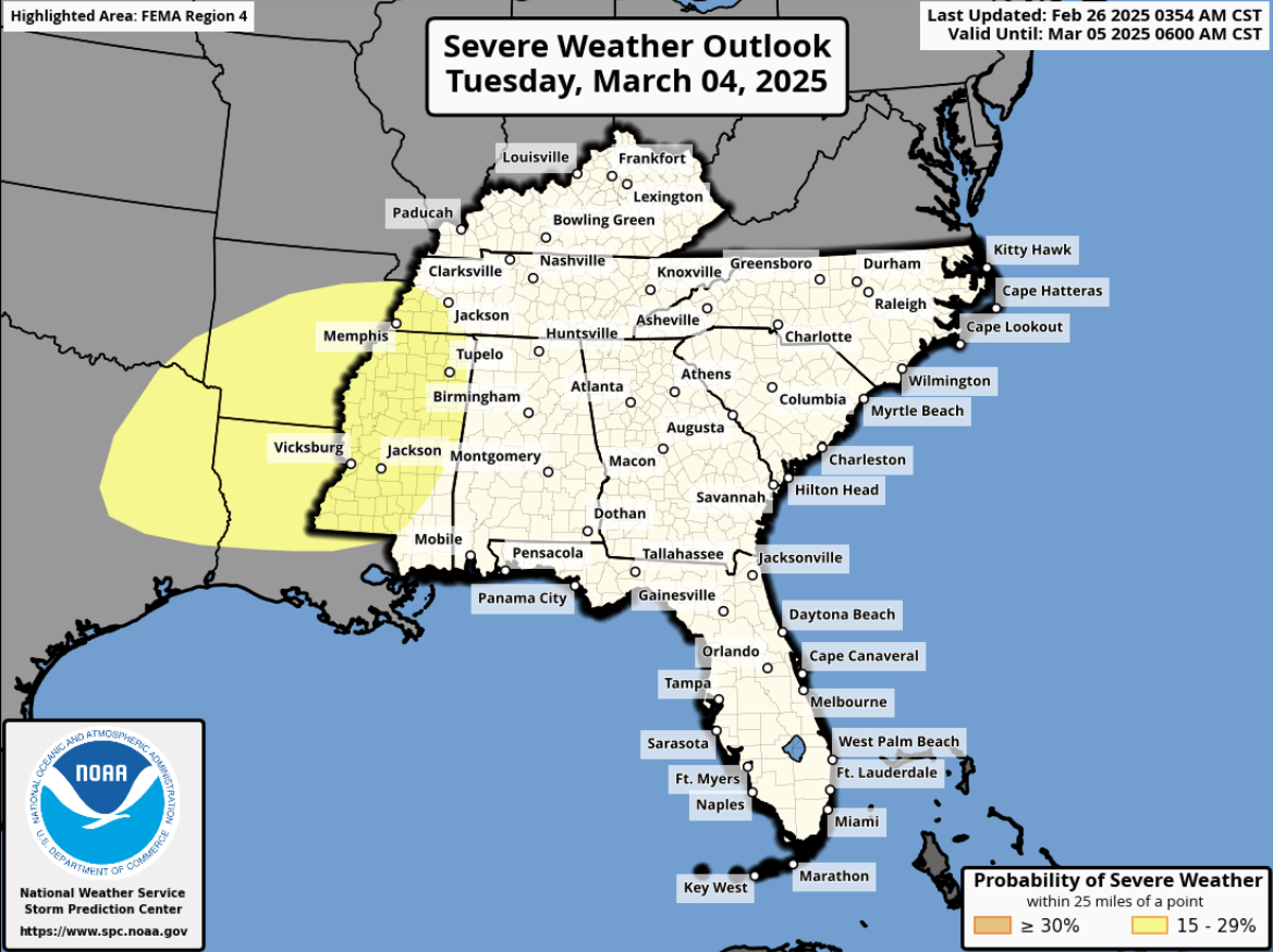
The Storm Prediction Center has highlighted an area to our southwest with a 15% chance of severe weather for next Tuesday. Nothing to worry about, but something to keep an eye on.
Categories: Featured Blog