
Last week was quite busy weather-wise – and we’ll get a much-needed break with some calm days ahead.
Temps in the low 40s this afternoon will allow for some legit melting. We’ll dip below freezing again tonight, so any wet pavement will turn into icy pavement.
We’ll gradually “warm” up over the next several days – topping out in the 60s early next week.
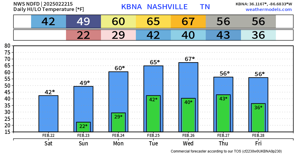
Dry weather until Wednesday or Thursday. Doesn’t look like a lot of rain – totals less than 0.5″ and no hazardous weather expected.
A few days ago, the Climate Prediction Center released their outlook for Spring – March, April and May.
Their thinking is above-average temps and above-average precipitation are slightly favored.
This doesn’t necessarily mean that the entire Spring will be warm and wet. We’ll still have our cooler and drier periods as we normally do with Spring.
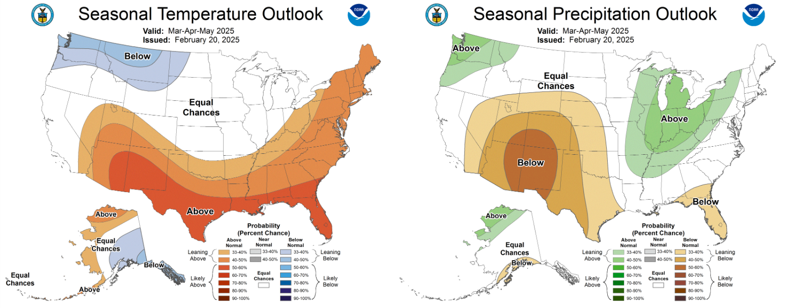
While severe weather is possible every month of the year here, Springtime can get a little busy. Our ENSO phase is expected to be La Nina throughout the Spring, which doesn’t guarantee a busier severe weather season, but several of our more active severe weather years have been associated with La Nina.
With Spring coming up, it’s as good of a time as ever to freshen up on your severe weather plan. Know where to go if a warning is issued for you. A good refresher can be found on our website here: What To Do.
Categories: Featured Blog