
The overall forecast remains on track.
Davidson Co. will be under a Winter Storm Warning from 9p tonight thru noon Wednesday.
Williamson Co. will be under a Winter Weather Advisory, also from 9p tonight thru noon Wednesday.
Davidson is under a Warning due to 3″+ of snow being more likely – which is the criteria for a Winter Storm Warning.
WillCo. will also see snow, but totals are expected to remain below 3″.
Timing:
ETA of first flakes likely 9 or 10p. This maybe differ by an hour or so, depending on how hungry or full the Dry Air Monster is. Once the 0z balloon data comes in we’ll likely have a much better picture on how hungry/full D.A.M is.
Majority of snow will fall while most of us are asleep.
Last flakes should fly around 6 or 7a Wednesday.
HRRR model guess below:

Snow will likely start to accumulate fairly soon once it begins to fall, so road conditions will likely start to quickly deteriorate overnight.
Wednesday AM rush hour will likely be negatively impacted.
We have no way to know how road ‘x’ will be at ‘y’ time, or if your flight will be affected. Interstates will be the first to be plowed, other roads to follow. The TDOT Smartway map is a good resource to see how road conditions may be.
Snowfall Totals:
Expected snowfall totals also remain on track.
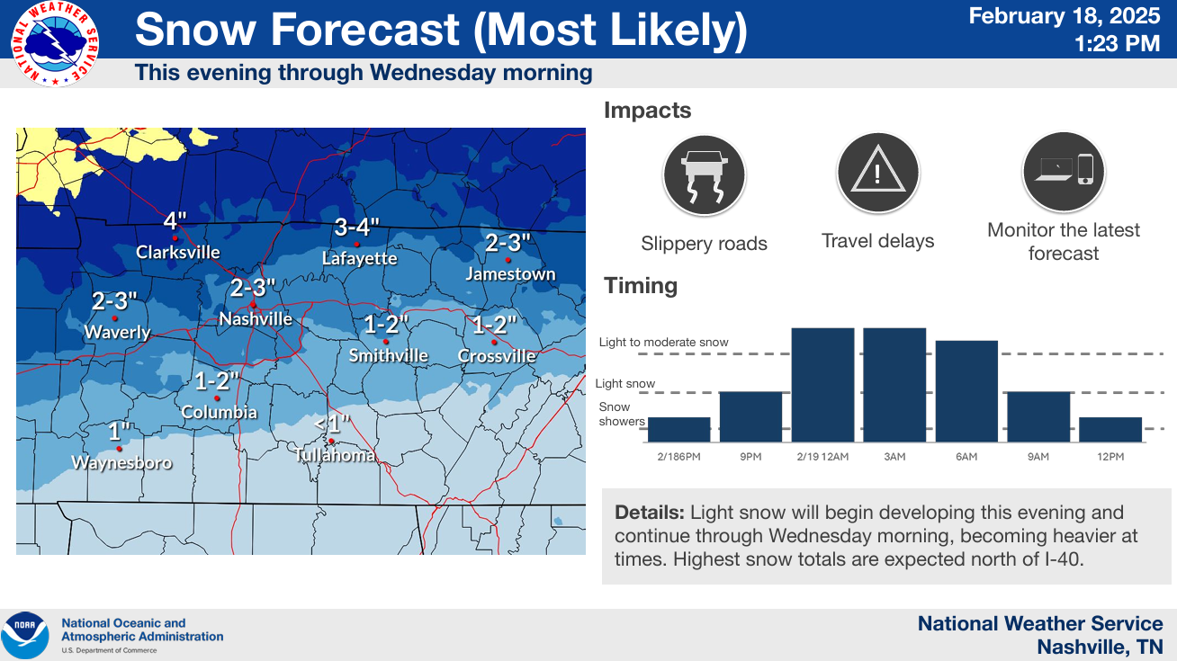
1 – 2″ likely S of 840.
2 – 3″ likely between 840 and I-40.
~3″, maybe 4″ N of I-40.
Some may see more, some may see less. That’s the joy of snow forecasting.
Changes still possible! Stay connected!
Confidence is high that this will all be snow, not expecting any icing worries.
Any snow will likely stick around for a while. Temperatures won’t get above freezing until Friday, maybe Saturday. Meaningful melting occurs this weekend.
Nights will be very cold – particularly Wednesday night/Thursday morning – when we have a Cold Weather Advisory.
“Very cold wind chills between 5 above to 4 below zero expected.” Hypothermia and frostbite can set in quickly under these conditions.
Other nights/morning also very cold, just maybe not as cold.
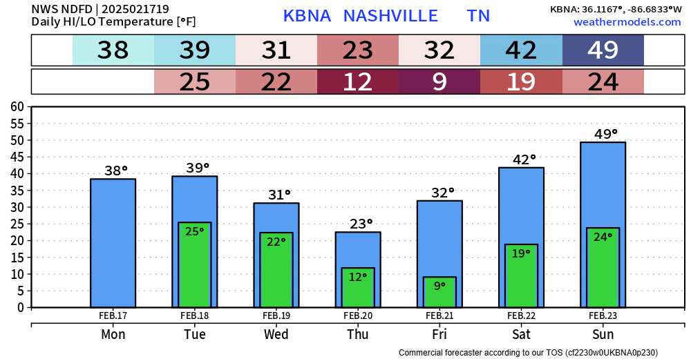
No additional precip chances in the forecast.
Categories: Featured Blog