

Headlines:
❄️ 1 – 4″ of snow expected
⚠️ Travel issues likely starting Tuesday night
🥶 Single digit lows possible later this week
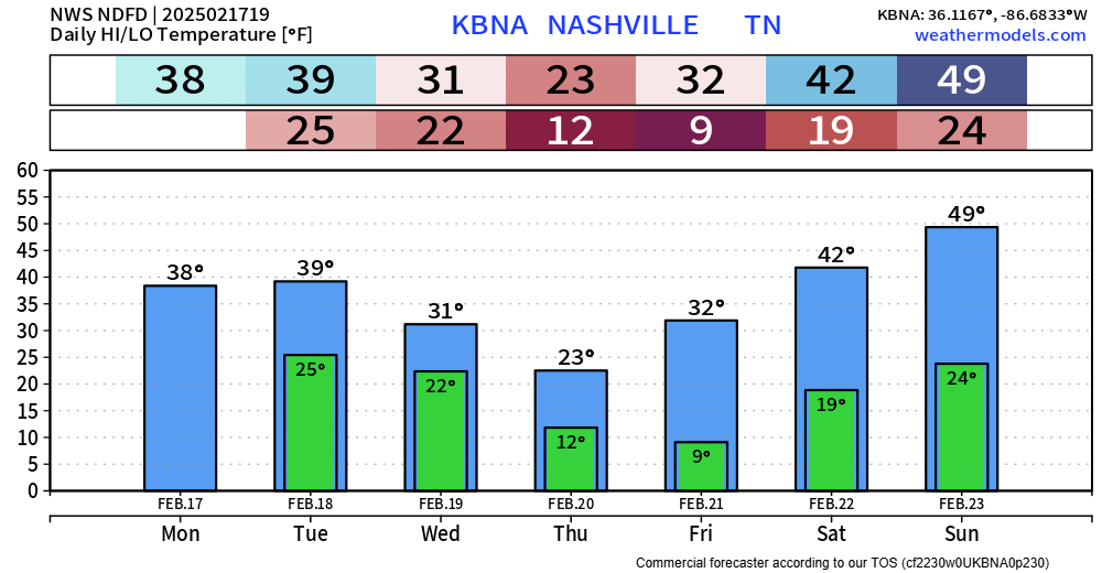
Sun is out today, but it’s cold. Most of us have not made it to 40° – and it will only get colder this week.
Tuesday during the day will be dry and cold.
Tuesday evening our next system moves in and will bring us our snow chances.
Timing:
Snow will likely move in sometime Tuesday evening, continuing overnight and end sometime Wednesday mid-morning. Majority of snow will fall while most of us sleep Tuesday night.
Road conditions will likely start to deteriorate quickly once the snow starts to fall. Backroads will be worse than main roads/interstates – although any road could be slick.
HRRR model (below) gives its’ best guess – this particular run has snow ending sooner than most other models do – something to watch.

Snowfall Totals:
Davidson Co. is under a Winter Storm Warning, while Williamson Co. is under a Winter Weather Advisory. This is due to accumulation totals expected to be higher the further N you are – but think everyone will get decent snow, regardless of if you are under a Warning or Advisory.
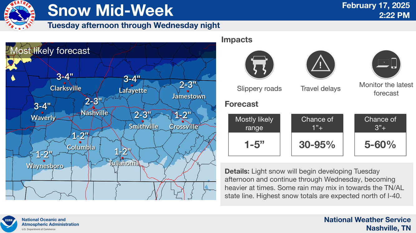
Most likely totals appear to be:
- 1 – 2″ S of 840
- 2 – 3″ between 840 and I-40
- 3 – 4″ N of I-40
Amounts subject to change!
I think a good “Boom” scenario (less than 10% chance) would be ~5″.
A “Bust” scenario (also less than 10% chance) would be ~1″.
Stay connected for any forecast changes!
Temperatures will likely stay below freezing Tuesday evening thru Saturday.
Thursday + Friday morning we’ll wake up with temps in the single digits/low teens. Thursday morning wind chills will be close to 0°.
Categories: Featured Blog