
In true Middle Tennessee weather fashion, we go straight from talking about our severe/flood threat to winter weather.
Much colder week ahead.

Temperatures will be below average the entire week – well below average Wednesday thru Saturday. Sub-freezing temps may be with us Tuesday evening thru Friday, maybe longer.
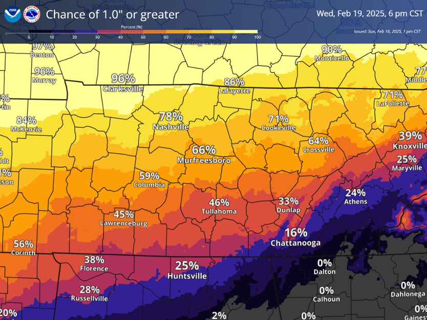
Our probability of accumulating snowfall has continued to increase over the past few days.
Confidence is high enough to where NWS Nashville and gone ahead and issued a Winter Storm Watch from Tuesday evening until Wednesday morning.
“Heavy snow possible. Total snow accumulations between 2 and 5 inches possible.”
Totals will be adjusted over the next several days.
Our current probability of seeing snowfall 1 inch or greater ranges from 60-80% in our two counties – higher probs N of I-40.
Our chance for snowfall totals 3″ and greater fall to 30 – 50%.
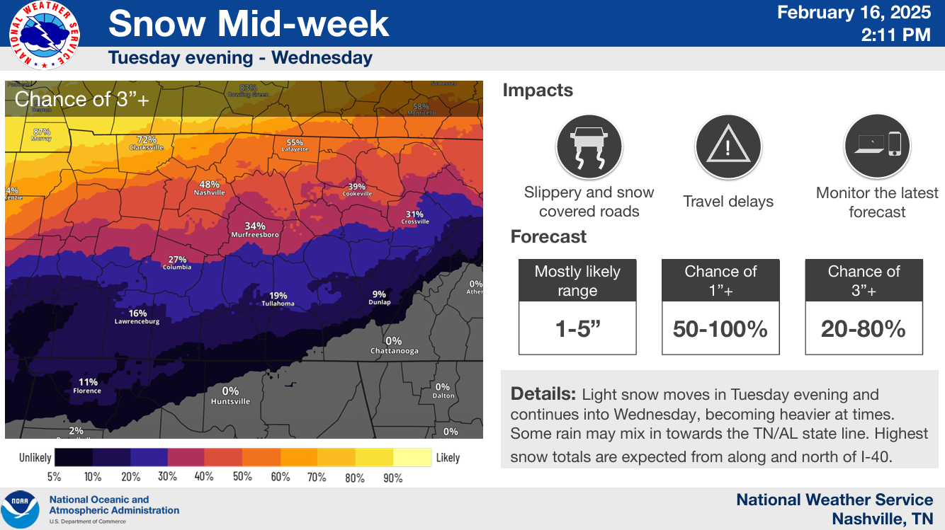
Snow would likely start sometime Tuesday evening and continue thru Wednesday AM.
Bottom line: Accumulating snowfall appear likely at this point for our two counties, but exact amounts remain unknown. Check back in for updates! Confidence will increase as we get closer to the event.
Regardless of snowfall amounts, bitterly cold temps will be with us starting mid-week.
Categories: Featured Blog