


We’ve already dealt with some flash flooding – along with creek/river rises so far today. This threat will continue thru Sunday as creek and rivers continue to rise with heavy rainfall expected tonight. If you come across a flooded roadway – turn around, don’t drown. If you see flooding that is threatening structures or vehicles, please send us a report using #tSpotter, with a pic and location if you can do so safely.
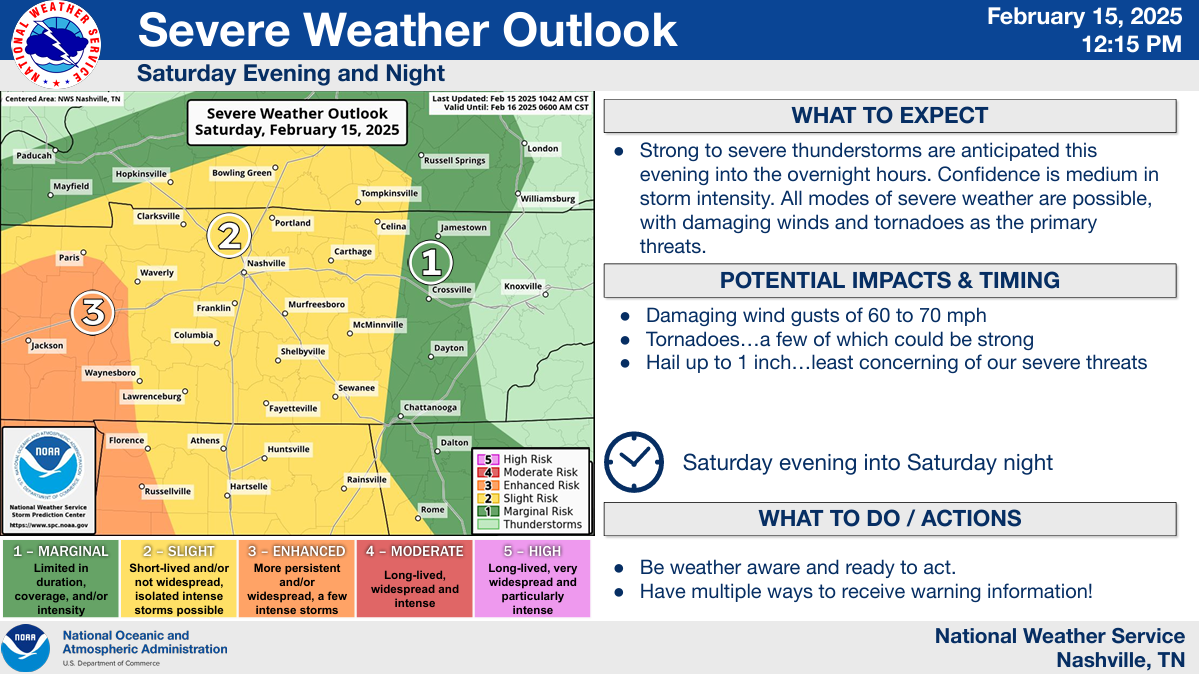
Our attention is still on our potential for damaging straight-line winds and a tornado or two this evening.
The Storm Prediction Center continues to have us outlooked with:
- a 15% chance for damaging straight-line winds
- a 5% chance of a tornado
Probabilities are for ‘x’ occurring within 25 miles of any given location.
Timing:
A line of storms is expected to bring us our potential for severe weather – with damaging straight-line winds being the main threat.
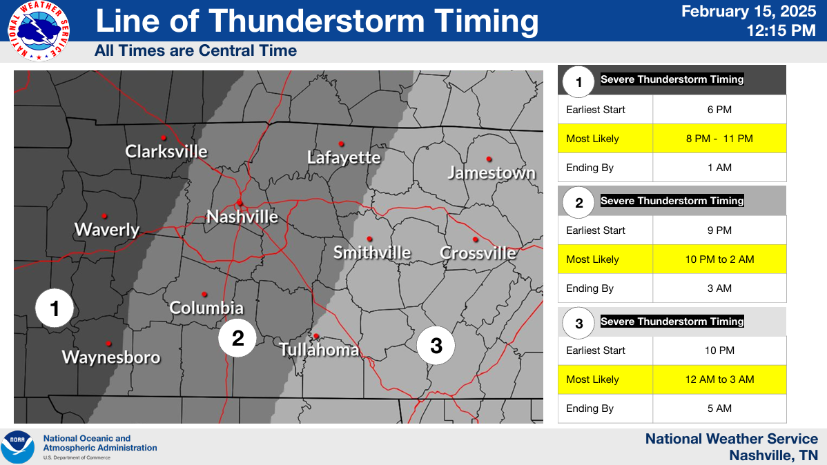
The most likely timing for the line of storms is from 10p to 2a.
We are still watching the potential for cells to form ahead of the main line. While unlikely at this time, if these were to form – they would carry the threat for severe weather.
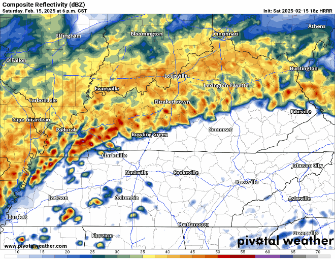
HRRR model (below) agrees with that timeframe, showing the brunt of the storms arriving ~11p to midnight.
With our saturated grounds, trees and power lines will be more likely to topple over due to strong winds.
Have a way to receive warnings tonight. NOAA Weather Radio, wake-me-up app (such as StormWatch+), the Wireless Emergency Alerts on your mobile phone (make sure they are turned on!) – all good resources. Do not rely on sirens to wake you up – they are not meant to be heard indoors. More specifics here: What To Do: Tornado Watch vs. Warning | Nashville Severe Weather
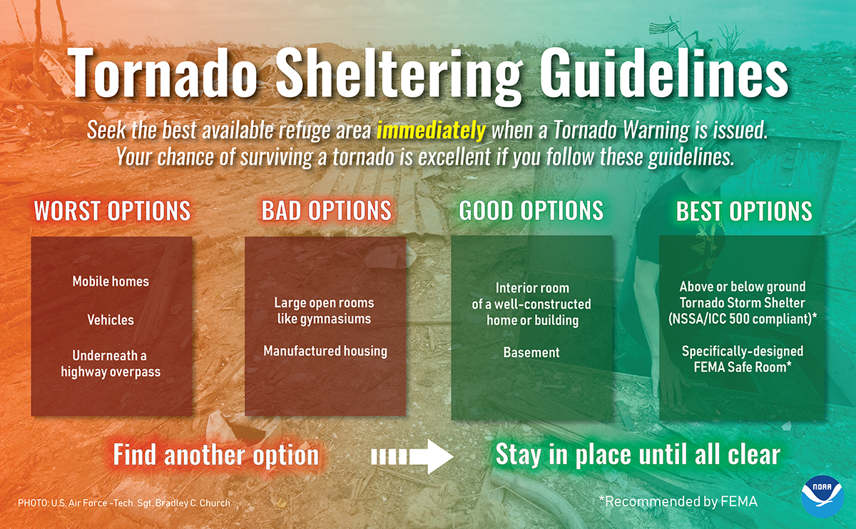
Tornadoes can spin up quickly in this type of event. If a warning is issued for you – be ready to act quickly and know where your safe place is. Lowest floor, most interior room, away from windows.
We’ll be up watching the storms – sending out updates as needed on our socials. We will go live on our YouTube channel if a warning is issued for any part of our two counties. Stay connected for any updates!
Cold air will quickly rush in behind the line of storms, and we could see a few flakes fly Sunday morning. No accumulation expected.
Much colder next week.
Still think snow is a possibility Wednesday-ish of next week.
More on that tomorrow.
 Log In To Facebook To Comment