
Headlines:
- A Flood Watch will be in effect from 12a Saturday to 12p Sunday
- “A significant rainfall event is expected to bring an additional 3 to 5 inches of rain to Middle Tennessee this weekend.” – NWS Nashville
- There is a low chance of severe weather Saturday afternoon and evening
- Confidence is very low for any winter weather potential mid next week
Before we jump into our very active weekend, the rest of today and Friday should be dry.
We’ll wake up to temps in the low to mid 20s Friday morning – the coldest we’ve dealt with in a while. A jacket will certainly be needed in the morning for the bus stop.
3 to 5 inches of rain is expected to fall from Saturday morning – Sunday morning. Granted, it will not rain the entire time. Heaviest rain most likely Saturday morning and Saturday evening/night.
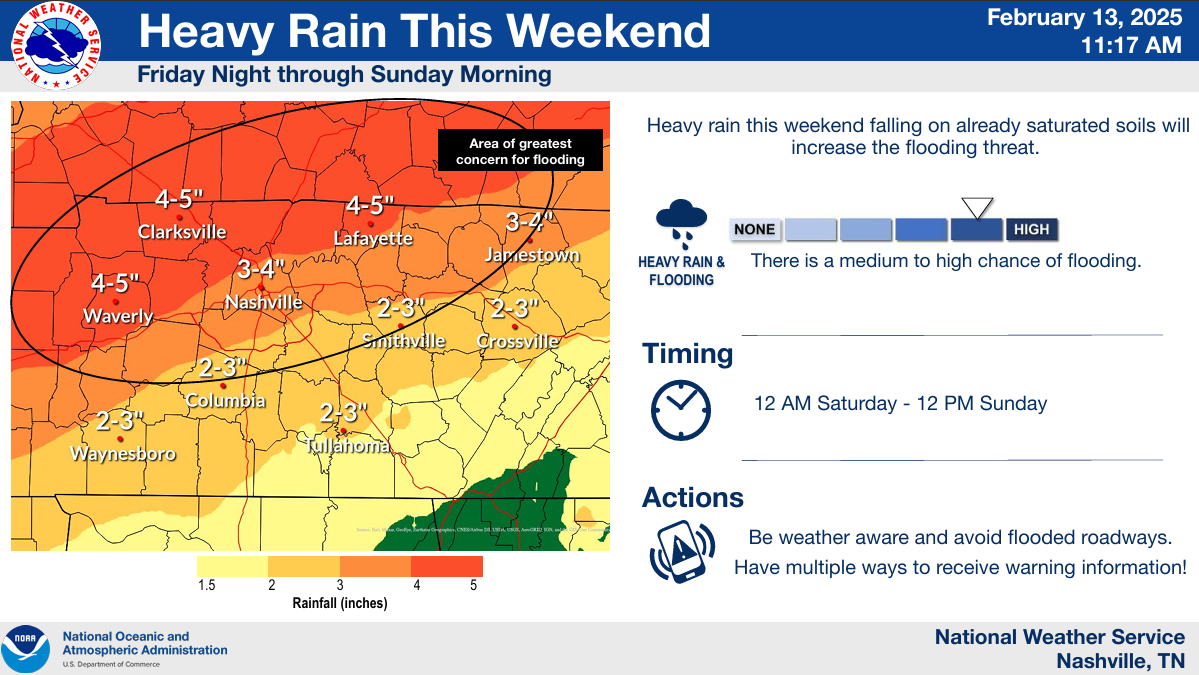
Confidence is high for heavy rain throughout the area. The axis of heaviest rainfall is currently forecasted to be just to our NW – more towards Clarksville and KY. This is where isolated totals of 5 to 7 inches will be possible.
While we are not currently expecting these amounts – it will be important to watch for trends in the models. Wherever this axis of heaviest rain ends up – significant flooding will be possible.
Have a flood plan in place if you live in a flood prone area. Even if you don’t live near a river/creek, flash flooding will also be possible. If you come across a flooded roadway, turn around – don’t drown.
The Weather Prediction Center still has us outlooked with at least a 40% chance of a flash flood event occurring within 25 miles.
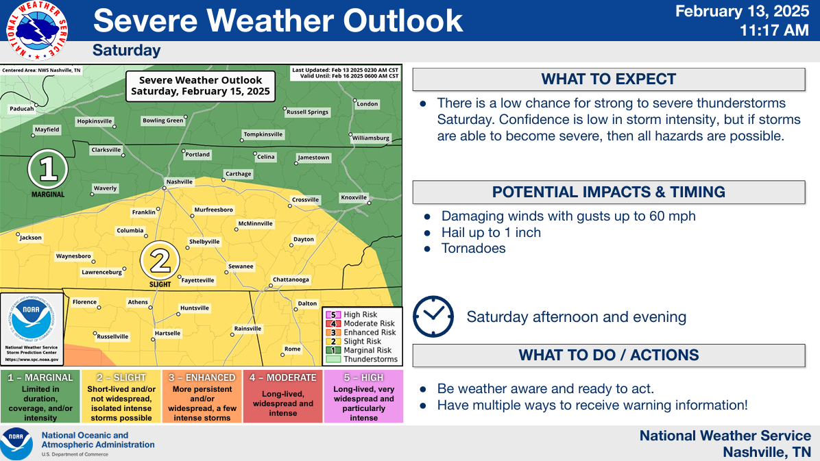
While not the main focus – the threat for severe storms Saturday afternoon and evening cannot be ignored.
The main area of focus is S of I-40, where there is a 15% chance of severe weather within 25 miles.
This still appears to be a conditional threat. IF instability (storm fuel) makes it this far north, then severe weather would be possible – damaging straight-line winds the main threat. Models aren’t totally sold on any instability making it this far north – this will have to be watched.
Changes to the forecast are possible (likely?) between now and Saturday. Please stay connected for any updates.
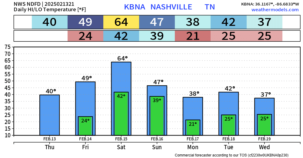
The only warm day in the forecast – Saturday. Rest of the forecast temps will be either at or below average.
With temperatures expected to drop to the teens and low 20s Monday morning, any moisture left on the roads could freeze. Will have to watch for any black ice potential.
Our next system is expected to roll thru mid-next week – and yes, there is some winter weather potential with it – but don’t get any hopes up yet.
“There is the possibility for another shot of snow/wintry precipitation in the guidance mid-week next week, but confidence is low in this solution as of now with how far out into the future the system is in the guidance.” – NWS Nashville Area Forecast Discussion
Model ensemble members are all over the place with this – some show absolutely nothing, others show a solid snow. Point is – no one knows. Shield your eyes from any crazy model posts – they are outliers and highly unlikely.
Something to watch, but focus is still on the threat for flooding this weekend, along with the severe storm potential.
Categories: Featured Blog