
Headlines:
- 2-5″ of additional rain is expected Saturday morning thru Sunday morning
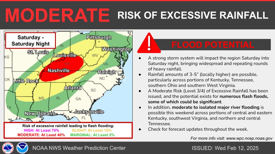
- There is increasing confidence regarding the potential for flash flooding during this time
- River/creek rises are also possible during this time
- Strong to severe storms are also possible Saturday PM
Rain will come to a pause (for now) over the next couple of hours. Rainfall totals have thankfully been light today, the same unfortunately cannot be said about this weekend.
But first, we are lucky enough to get two dry days out of Thursday and Friday.
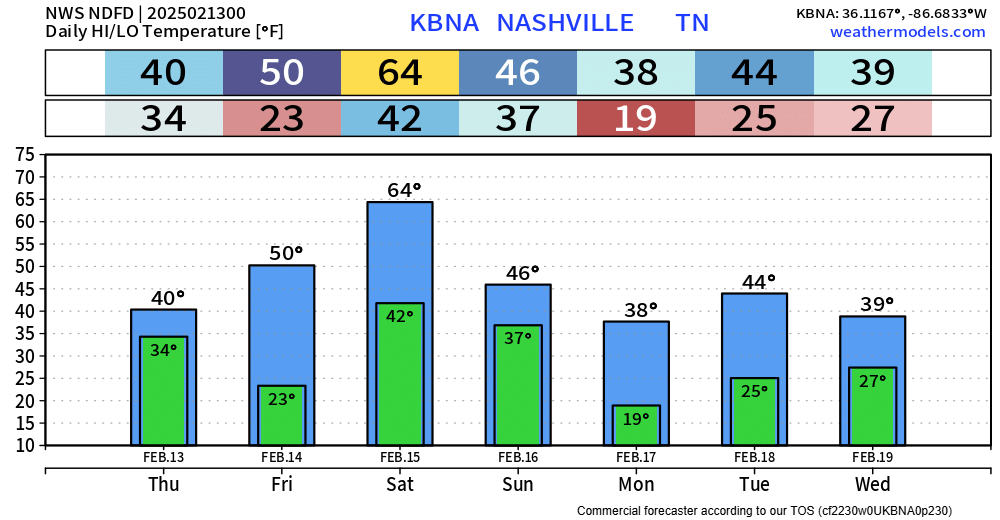
We won’t get so lucky with temperatures. High temps will struggle to make it out of the 30s Thursday, with a hard freeze into Friday morning.
Now onto our flooding potential.
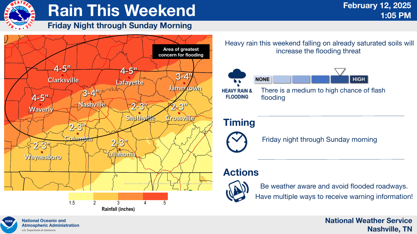
Rainfall totals from Saturday morning to Sunday morning are expected to be in the 2-5″ range for our two counties, on top of already saturated soils – this could lead to some issues.
The Weather Prediction Center has given us at least a 40% chance of a flash flood event occurring within 25 miles on Saturday.
In addition, river flooding could become an issue starting early next week.
Now is the time to prepare if you live in a flood plain.
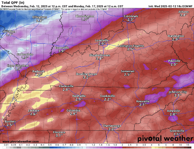
At this time, models think that a band of heavier rain will set up somewhere close. Where this ‘somewhere’ occurs is unknown at this time.
Below, shows 5 different model depictions of rainfall totals this weekend. All show the band of heavier rain setting up too close for comfort. A lot will likely change between now and Saturday, and this will have to be watched carefully.
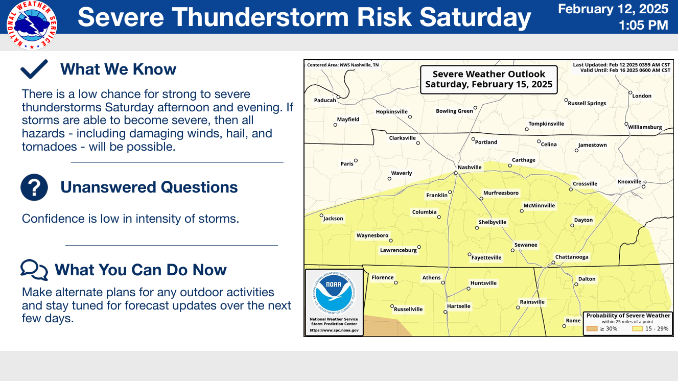
In addition to the threat for flooding, there is also a chance for strong to severe storms Saturday, particularly during the afternoon and evening.
This threat is conditional, and it all depends on how far north the instability (storm fuel) gets. If it does get this far north, all modes of severe weather would be possible – with damaging straight-line winds being the main threat.
Confidence is low in this, and changes are likely to the forecast.
The higher resolution models are not in range yet – so details are a bit iffy about all of this. Main takeaway, heavy rain is probable this weekend.
Next week looks much cooler. There are some rumors flying around about winter weather potential, but this is nothing more than a rumor at this time. The focus is on the flooding and severe weather potential.
Categories: Featured Blog