


Headlines:
- Two rounds of heavy rain will lead to potential flooding issues, rises in creeks/rivers
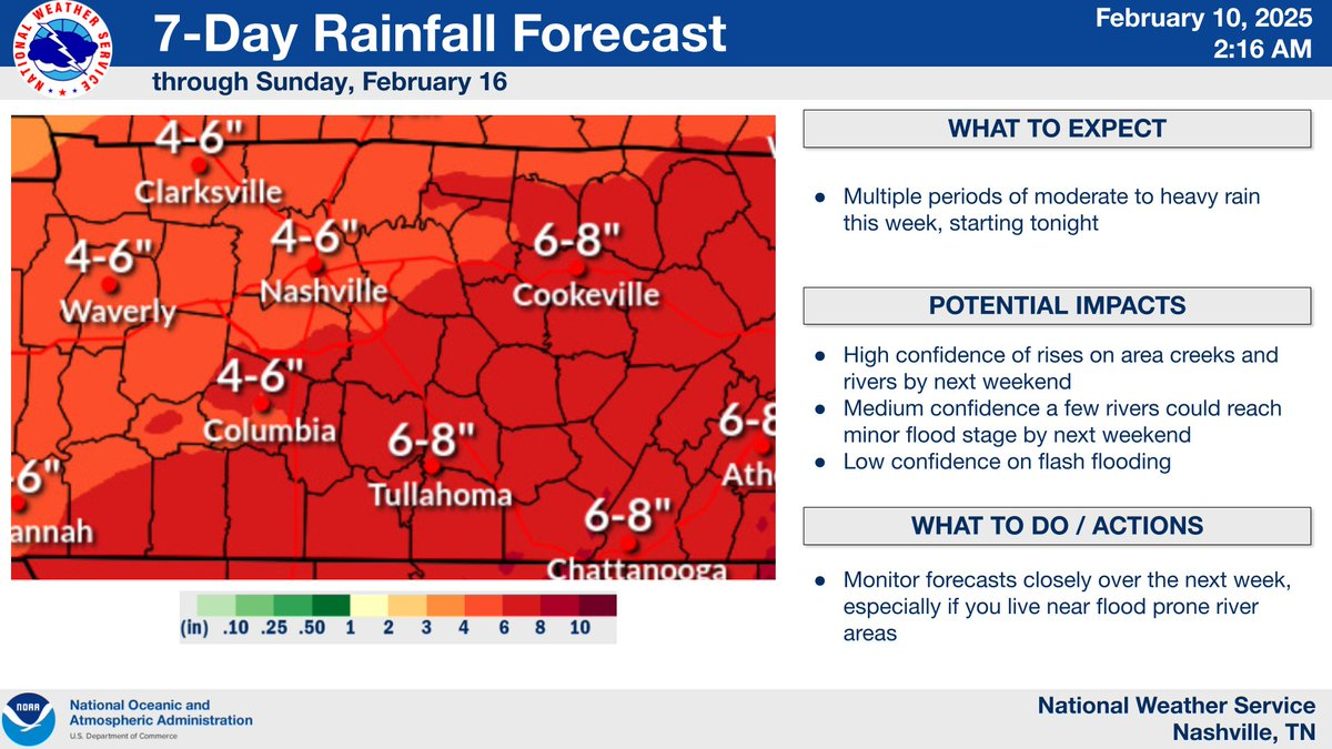
- Rainfall totals thru Sunday will likely add up to 4 to 6″, locally higher amounts possible
- No severe or winter weather concerns right now
Round One of Heavy Rain: Tonight – Wednesday Night
Rain will move in late tonight and stick around for the majority of the day Tuesday. We will probably get a break overnight Tuesday thru Wednesday morning, with more rain Wednesday PM.
1 – 4″ expected from this first round, most of us will end up in the 1-3″ range.
Euro model gives a guess at how the radar could look.

“So given the relative dryness that still pervades much of the mid state, it appears that we should be able to absorb these rainfall totals without much risk of flooding.” says NWS Nashville.
AKA, the overall flooding risk for this first round should be relatively low – although some low-lying, flood prone areas could see some ponding. This round will more be of a set up for our higher flood potential this weekend.
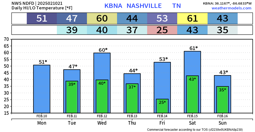
Thursday + Friday we get a break from the rain. Temps will be cool, but seasonal.
Round Two of Heavy Rain: Saturday morning thru Sunday Morning
Our next round of heavy rain arrives Saturday morning, although a few showers could be possible Friday night. On and off heavy rain will stick around for most of Saturday, exiting our area by Sunday morning. Any outdoor plans Saturday should have an indoor back-up plan – which will probably be needed.
While some thunderstorms are possible, any are expected to stay below severe limits.
Rainfall totals with this round expected to be 2 to 4″.
Flooding potential will be higher with this round due to the ground already being saturated from Round One.
Rivers/creeks could rise and get close to flood stage due to all the rain – flood prone areas should monitor this.
Flash flooding will depend on rainfall rates.
Specifics will be adjusted over the next several days, and details will likely change!
We’ll have updates on here and all of our socials throughout the week, those who live in a flood prone area should monitor the forecast closely.
 Log In To Facebook To Comment