


Rain expected to move in tonight, sometime around 9p – give or take a couple of hours.
Should continue on/off thru about midday Saturday, but some sprinkles can’t be ruled out Saturday afternoon and evening.
HRRR model gives a guess below.

Then, some flurries might get squeezed out as our cold air arrives during the morning hours of Sunday.
A dusting can’t be ruled out, especially on elevated surfaces – but think it will have a hard time accumulating with the warm ground. Can’t ever fully trust a snow forecast in TN tho – we’ll be watching.
The main highlight of the forecast continues to be the coldest air of the season that will move in for the first half of next week.
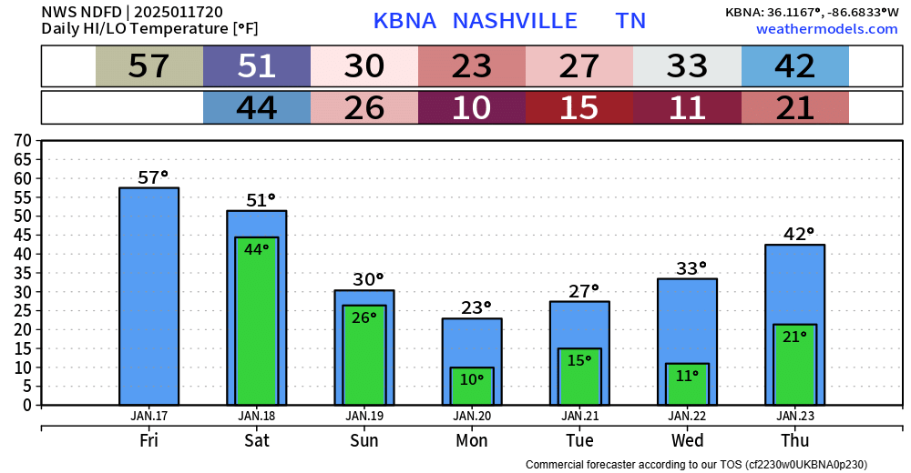
The expectation is still that temperatures will fall below freezing Saturday night and not get above freezing until Wednesday, possibly Thursday.
Monday, Tuesday, and Wednesday mornings we’ll wake up to temps in (or very close to) the single digits, with wind chills values near 0°.
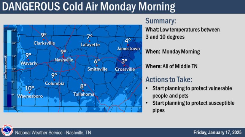
Now is the time to start preparing a warm spot for pets inside and protecting any vulnerable pipes.
Layers will be needed if you plan on being outdoors for any extended amount of time early next week, frostbite can set in quickly with temperatures as low as they are forecasted to be.
Besides our flurries on Sunday, not seeing any other legit chances for winter weather in the foreseeable future. Better chances for that exist closer to the Gulf Coast – yes, the Gulf Coast.
 Log In To Facebook To Comment