


Still expecting some showers to move thru starting late Friday night, continuing on/off thru midday Saturday. No thunderstorm worries, just some rain.
HRRR model gives its take below.

Most of the rain should be outta here by about noon on Saturday.
Still can’t totally rule out seeing some flurries on Sunday, but no accumulation is expected.
Temperatures will be close to average Friday and Saturday – then our coldest temps so far this season arrive early next week.
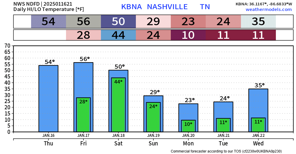
Temps will drop below freezing Saturday night and won’t get above freezing until at least Wednesday.
Highs only getting to the low 20s on Monday and Tuesday, with lows likely creeping into the single digits. Wind chill values close to 0° likely.
This will be the coldest air we’ve had in a while. Now is the time to winterize your home to its needs! Remember to protect Pipes + Pets.
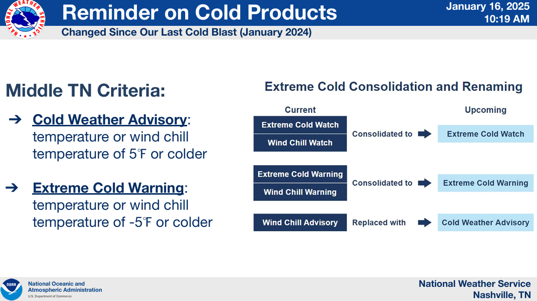
We’ll likely see either a Cold Weather Advisory or an Extreme Cold Warning issued. These are new products, replacing the old Wind Chill Advisory/Warning. More info on that below.
Chances for any winter precip with this cold air still look nil. Models continue to be all over the place, per usual with winter weather in the South. Still keeping an eye on it, but nothing super noteworthy in the models right now. Better chances still confined to our south.
 Log In To Facebook To Comment