


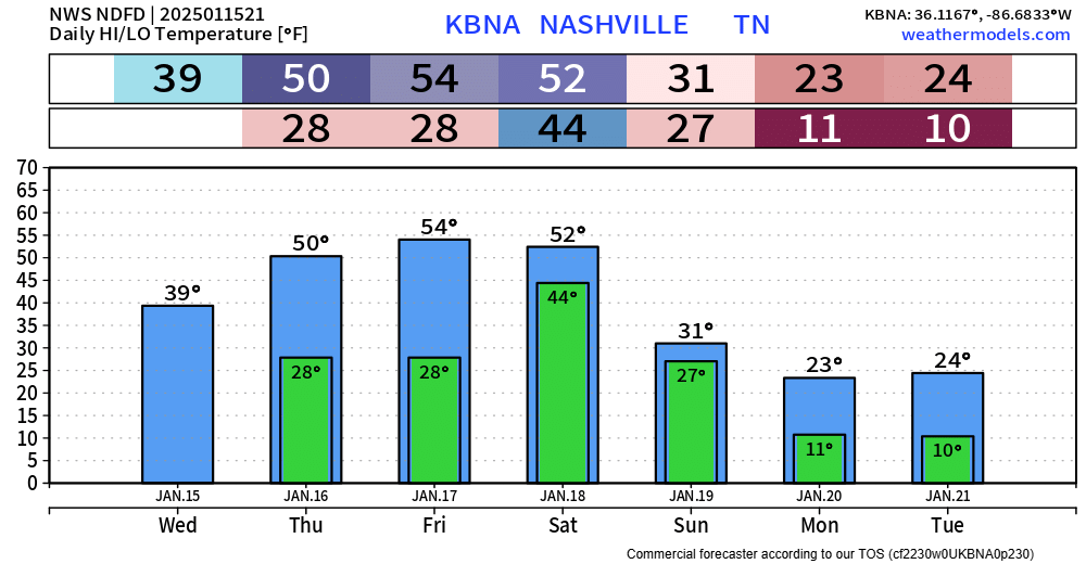
Before we jump straight to next week, we still do have rain chances beginning Friday night, continuing into Saturday.
The Euro model (below) thinks rain doesn’t move in until late Friday night and is out of here by midday Saturday.
No thunderstorms expected with this. Just rain, totals around 0.5″.

Can’t rule out some flurries on Sunday morning, but no accumulation is expected.
Now onto the headline of the forecast, which is the incredibly cold air expected to move in early next week.
There is high confidence that we’ll experience temperatures well below average for at least the first half of next week.
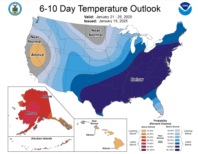
In fact, it is possible that temperatures go below freezing Sunday morning, and do not get above freezing until Wednesday or Thursday.
Highs stuck in the low 20s on Monday and Tuesday, with wind chill values near 0° possible each of those mornings.
That’s cold.
While temperatures will be fairly average thru Saturday, things will quickly change. Now is the time to start thinking about how to winterize your home to its needs.
The uncertainty for next week (specifically, middle of next week) is any winter weather potential.

Models are all over the place with this. If anything, the odds for winter weather are better to our south. Yes, south – not too usual to hear that.
Right now, the trends and odds don’t look great for any winter weather – at least for us. We’ll still keep an eye on it and keep y’all updated on any updates.
 Log In To Facebook To Comment