

All things considered, not a bad night to ring in the New Year. Dry, but will be chilly. Jackets needed tonight for any outdoor celebrations.
The first few days of 2025 will be dry but cold – however temps will be pretty close to normal…for now.
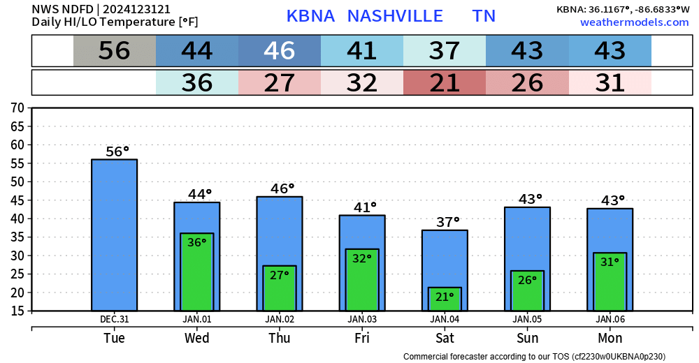
Our main focus is still on the below-average temperatures and the potential for winter weather next week. The below-average temps are basically a guarantee at this point, but the winter weather stuff is far from any guarantee.
The 6 – 10 day outlook (Jan 6 – 10)…
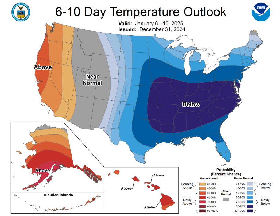
and the 8 – 14 day outlook (Jan 8 – 14) both show below-average temperatures will be very likely.
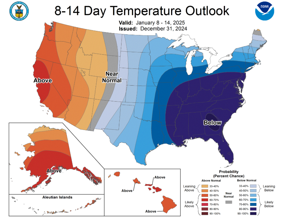
Our averages for this time of the year are highs in the upper 40s with lows in the low 30s. Right now, it’s unclear on how far below average these temps will get. Some models are sold on Arctic air getting in here (single digits), others not so much. It’s a waiting game. Still, not a bad idea to start thinking on how to winterize your home.
Another thing to watch is our system that is expected to move in early next week.
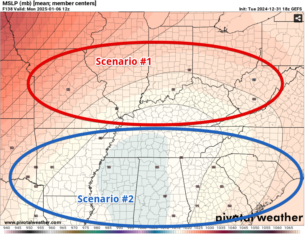
Yesterday, we took a look at two different ensembles (the GFS and the Euro) to see where the different members thought the center of low-pressure may track.
(Scenario #1): If the low-pressure system takes a track north of us, temps will stay warm enough for any precip to stay liquid.
(Scenario #2): If the low-pressure system goes more over us or to our south, then temps could be favorable for winter weather to be a possibility.
I’m going to show both of the different ensembles again to watch for any trends. Again, the tiny numbers are where each of the different members think the center of low-pressure will be.
The newest Euro ensemble (shown valid late Sunday night) continues to show a fairly even split between the members. Maybe a few more showing Scenario #1.
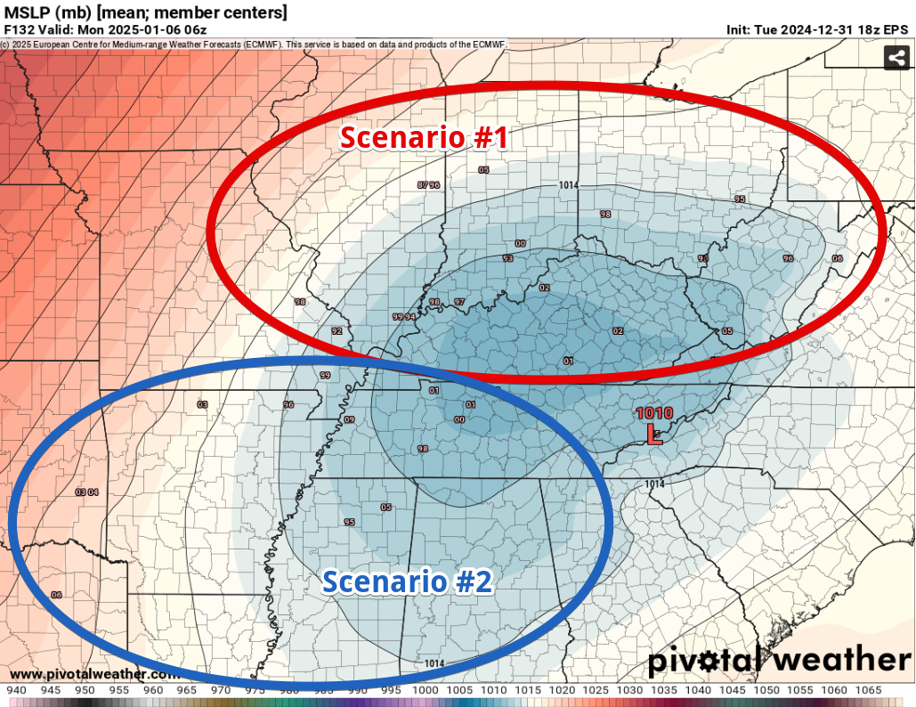
The latest GFS ensemble (shown valid early Monday morning) is a bit more interesting. It has quite the shift southward (compared to yesterday’s runs), with a lot more members showing Scenario #2.
Does this trend hold? Does the Euro trend southward? So many questions that still have yet to be answered and just cannot be answered 120+ hours out.
These trends will be something we continue to watch. The deterministic model runs (the single, solo, wild ones) are still all over the place. As we continue to get closer, the models will likely begin to agree more, and we’ll get a better idea of what to expect.
Please continue to shield your eyes from any crazy model screenshots that show obscure numbers. These are outliers and are very unlikely.
For now, we are expecting precipitation sometime Sunday/Monday. Exactly what kind of precipitation is unknown. It could be multiple kinds, who knows. We’ll continue to keep y’all updated!
Andddd long range guidance shows more precipitation chances later next week, but we’ll just do one at a time.
Categories: Featured Blog