
First, a line of heavier showers is expected to move thru the area Friday morning. No severe weather expected, just some rain.
HRRR model gives a guess below:
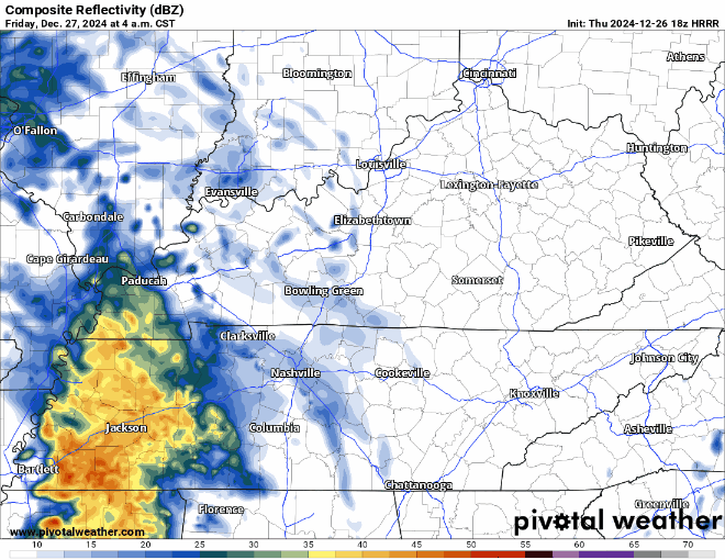
Majority of the rain should be gone by noon. Maybe a stray shower in the afternoon/evening, but majority of plans should be dry.
Then, we have a low-end threat severe weather/minor flooding threat Saturday PM into early Sunday.
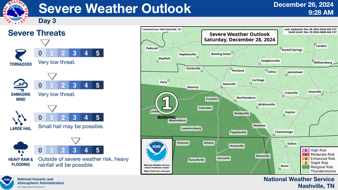
While the higher threat exists to our southwest, there is a 5% chance within 25 miles of a severe storm Saturday.
There is also a 5-14% chance of flash flooding occurring within 25 miles.
At this time, the severe threat looks very low. There is a great deal of uncertainty that all the ingredients (instability, wind energy, moisture, lift) all come together at the same time.
Early indications from the higher-res models show the ingredients not really coming together – this is good news. This could of course change, we’ll be watching and keeping y’all posted with any updates. No need to hit the panic alarm.
Regardless, of severe weather threat – we still look to be in for some heavy rain.
Rainfall totals for the next 5 days look to end up in the 1 – 3″ range, with locally higher amounts possible. While widespread flooding issues are not expected, a few localized areas could see some minor flooding issues – especially the flood-prone areas.
More details to come tomorrow as more model data pours in.
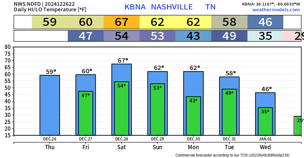
Above-average temps likely to stick with us thru the end of the year, with colder temps coming in as we turn the page into 2025.
“NYE Celebrations are trending dry and cool with gusty northwesterly winds for now, but something to keep an eye on.” says NWS Nashville. Once we get thru this system Saturday, we’ll likely have a better idea.
Categories: Featured Blog