
Models have been trending drier for Christmas Eve + Christmas Day.
The NWS Blend of Models shows relatively low chances (>20%) of any measurable rainfall during both days.
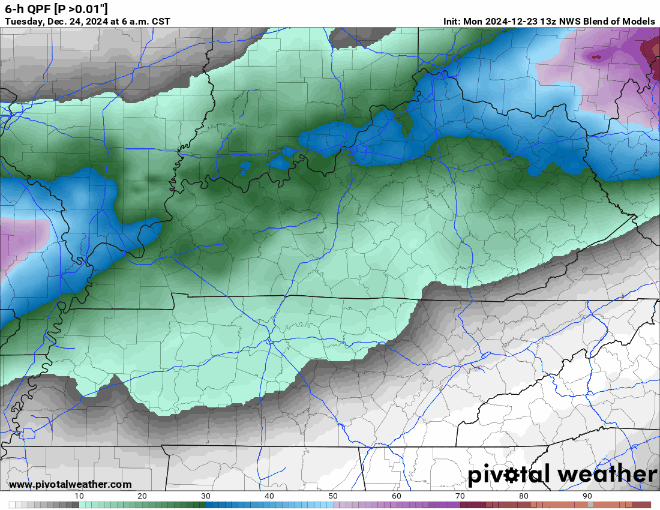
Won’t be surprised if a few of us see a quick shower, but certainly not a washout either day. Good weather to try out those new toys.
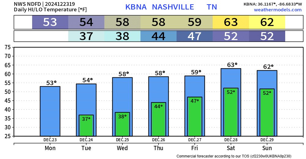
Temps will slowly be on the come up.
Christmas Day high temps in the upper 50s, with temps staying above freezing at night.
Highs creep all the way up into the low 60s by the weekend.
Much higher rain chances (50-70%) will come into play Friday thru Sunday.
Instability still looks low at the moment, so thunderstorm chances remain low.
“Highest rainfall totals right now look to be Saturday night into Sunday, and when its all said and done, 1 to 2 inches of rain is in the forecast Friday through early next week.” – NWS Nashville Area Forecast Discussion
Categories: Featured Blog