
New data is always arriving which means the forecast is pretty much always changing in some sort of fashion. This is no big change, but I suppose something to note!
There is a relatively low probability that we could see some flurries Friday evening and into the overnight hours.
The HRRR is not a very big fan of our flurry chances. Loop goes from Friday midday to Saturday morning.
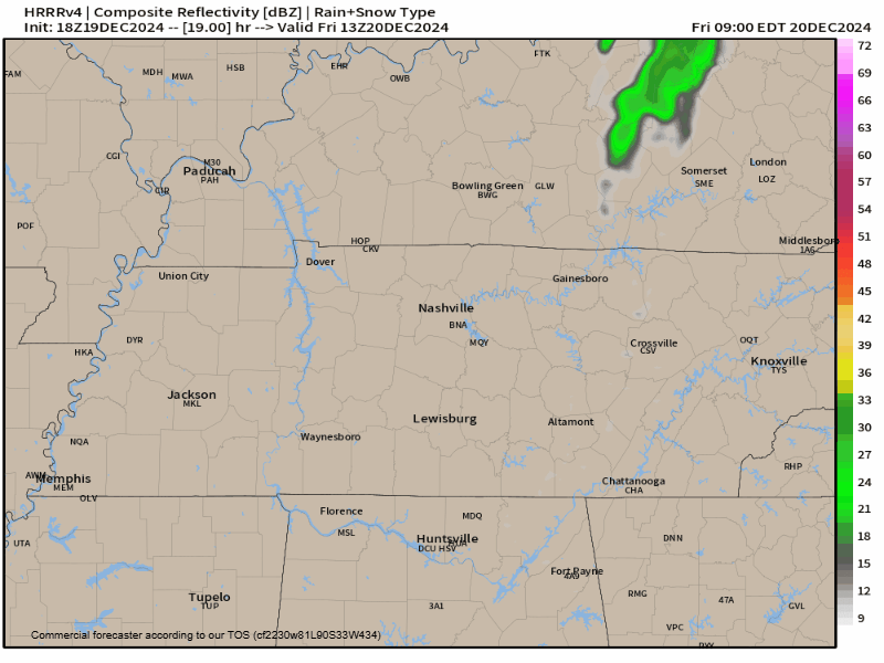
Reasons for discouragment:
– Temps are expected to be above/right at the freezing mark
– Lots of dry air is expected to be aloft (hey Dry Air Monster), so it’ll take a lot for any flurries to reach the ground
Reasons for encouragment:
– Impossible to fully trust a Middle TN snow forecast
For now, this just looks like a few flurries to melt on contact with the ground. Forecast could change, but for now – meh. No travel impacts expected.
Besides all that! A cool weekend lies ahead.
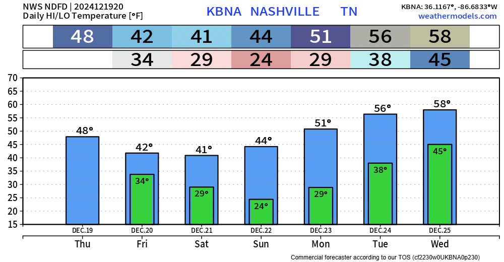
Temperatures will start to increase as we get closer to Christmas Eve, Christmas Day – and rain chances will increase as well.
“I still like the idea that Santa will escape rain when he arrives in Middle TN, but by a skinny hair of his beard because as we move into the second half of next week, it looks like we`re going to get into an active weather pattern with at least some rain chances each day through next weekend.” – q from the great minds at NWS Nashville
Still a good deal of uncertainty with timing, but rain at some point near/on Christmas looks like a good bet, with rain chances staying in the forecast for the rest of next week.
We’ll keep you posted with the deets as they roll in.

Good news: drought improvement.
Categories: Featured Blog