
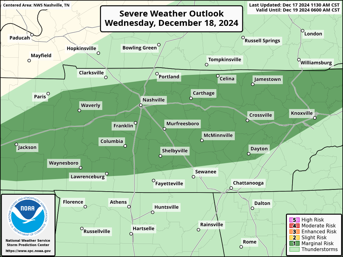
The Storm Prediction Center has outlooked our two counties with a low-end severe weather threat Wednesday morning.
- 5 – 14% chance of damaging straight-line winds within 25 miles
- 2 – 4% chance of a brief tornado within 25 miles
Although this is a very low threat, this is still something to keep an eye on. Probabilities subject to change.
Timing
Our *current* timeframe for severe weather potential is 4a – 10a. This could change!
The HRRR model gives its best guess on how this plays out below:

Current indications point to scattered storms at first in the wee hours of the morning, with a more organized line arriving around the morning rush hour. Heavy rain likely to last for a few hours before departing sometime early Wednesday afternoon.
With the threat beginning while most of us are still sleeping, it will be important to have multiple ways to wake up if a warning is issued for you. Whether it be a NOAA Weather Radio, the Wireless Emergency Alerts on your phone, a wake-me-up app on your phone – the more the merrier. Do not rely on tornado sirens to wake you up.
This is a pretty typical December severe weather set up, with plenty of shear/wind energy and very little CAPE (storm fuel). While the overall chance of severe weather is very low, this isn’t something to press snooze on and get caught off guard.
We’ll be up sippin’ (or chugging) coffee and watching. *If* a warning is issued for any portion of our two counties, we’ll go live on our YouTube channel. You can get to it by clicking here: Nashville Severe Weather @NashSevereWx – YouTube You can subscribe and turn on notifications to know whenever we go live. We’ll also be sending out updates as usual on X/IG/Threads/BlueSky.
Regardless of if we do see any strong to severe weather – we’ll all likely see some heavy rain.
There is a Flood Watch for Davidson Co. (WillCo. not included) from midnight thru noon on Wednesday.
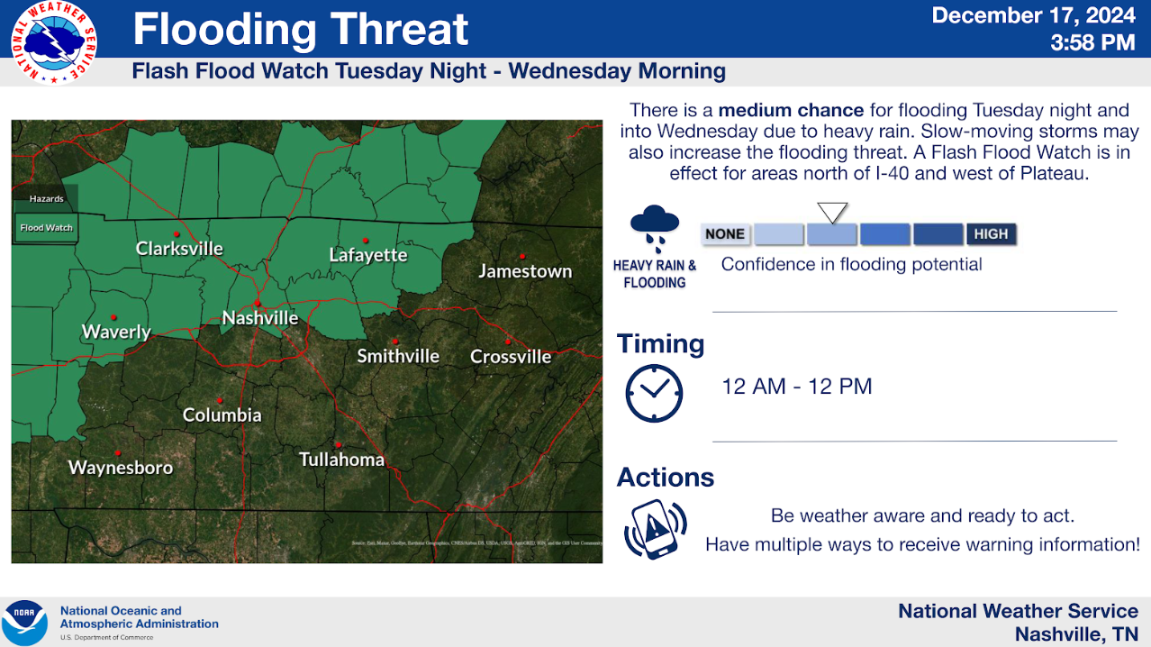
“Excessive runoff may result in flooding of rivers, creeks, streams, and other low-lying and flood-prone locations.” – NWS Nashville
Heavy rain, combined with arriving close to rush hour Wednesday morning will not be a good combo. Allow plenty of time to make it to school/work, and if you come across water across a road, turn around, don’t drown.
Rainfall totals generally in the 1 – 1.5″ range, with locally higher amounts possible.
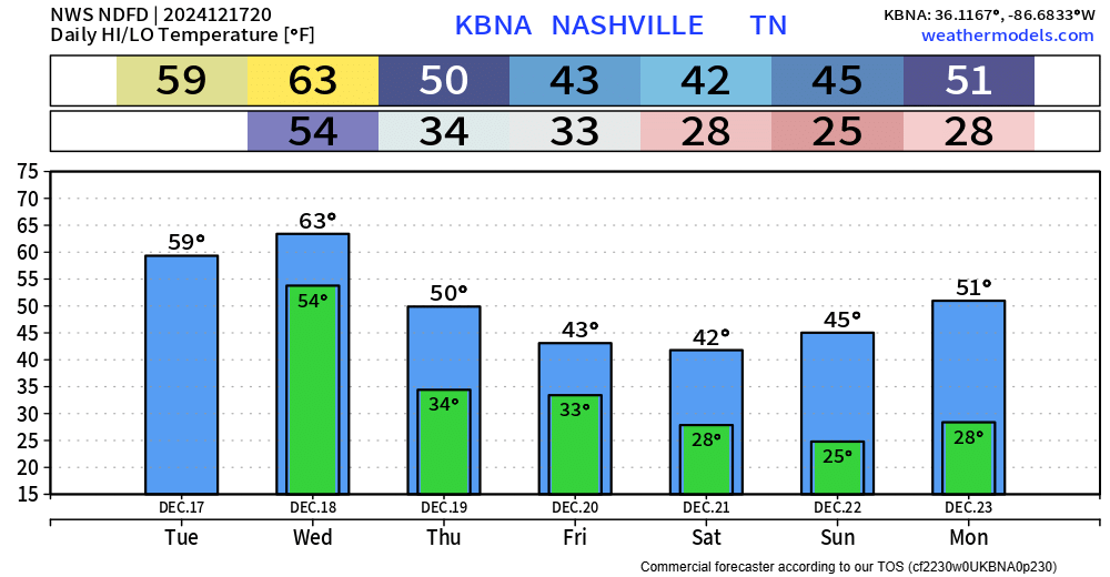
Good news is that the rest of the week looks dry, although it’ll be noticeably cooler.
Categories: Featured Blog