
BNA managed to climb all the way up to 78°, just two degrees shy of tying the daily record high of 80° set back in 1985.
Tuesday will still be warm, but we’ll have some showers in the AM.
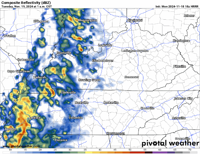
HRRR model shows:
*Rain arriving in the wee hours of Tuesday morning
* Departing around lunchtime Tuesday
* Rain jacket or umbrella a good idea for the walk into work or school
* A rumble of thunder possible, but no strong storms expected
* Rainfall totals expected to stay under 0.5″
While the rest of the week looks dry, we’ll be in for quite the change temperature wise.
A stiff breeze from the northwest will pick up starting Wednesday afternoon, beginning the temperature drop. Wind gusts up to 30 mph will be possible during the day Wednesday and Thursday, making temps feel slightly cooler than they actually are.
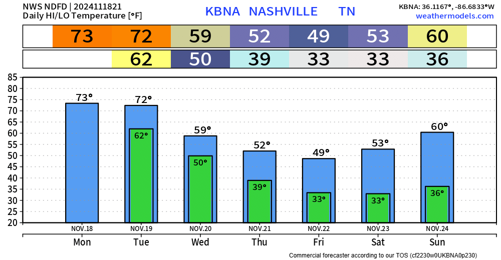
High temperatures will struggle to reach 50° Thursday thru Saturday, with lows getting close to, if not getting below freezing.
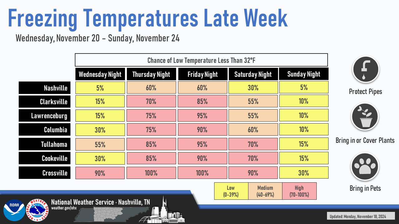
This neat graph made by NWS Nashville shows chances for temperatures less than 32° at 60% Thursday & Friday night in Nashville.
Temps usually a couple of degrees warmer near Nashville due to the Urban Heat Island effect, so it is possible that your backyard goes below freezing while BNA stays above.
*If* BNA stays above freezing this weekend, the record for latest freeze on record (November 27) will probably be broken, as temperatures are expected to warm back up starting early next week.
Categories: Featured Blog