


Dry and warm today and Monday. Highs in the low 70s, 12-15° above average.
A thin line of showers is expected to move thru our area early Tuesday morning, providing us with a little rain, but not much else.
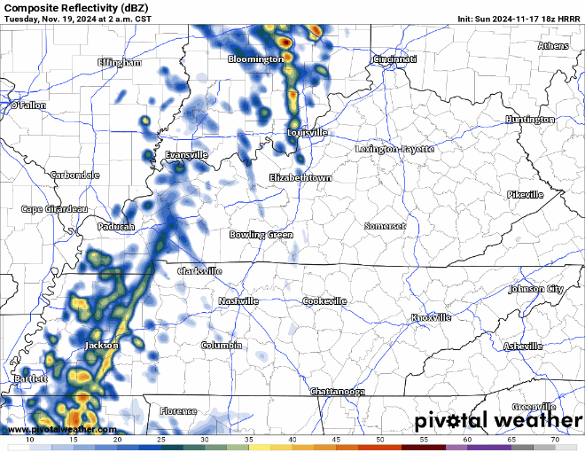
Latest HRRR model thinks majority of rain is outta here by 8a – timing could be off by a couple of hours.
Temperatures will begin to take a tumble starting Wednesday.
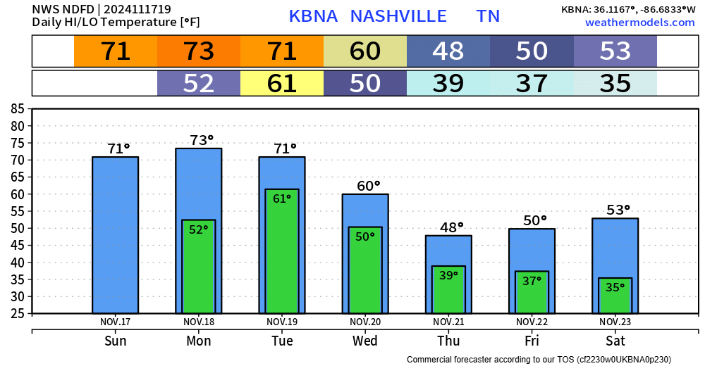
Wind gusts out of the NW at 25-30 mph will be possible during the day Wednesday + Thursday, making it feel even cooler.
Euro model thinks we could see a few showers Thursday PM, GFS says nah. Either way, they would be of little to no consequence and would fall as liquid.
Highs will be near 50° Thursday – Saturday, waking up to temps in the mid 30s each morning. Still unclear if we reach the freezing mark, it’ll be close. If we don’t hit the freezing mark this weekend, the latest Fall freeze on record (November 27, 2009) very well may be in jeopardy.

 Log In To Facebook To Comment