
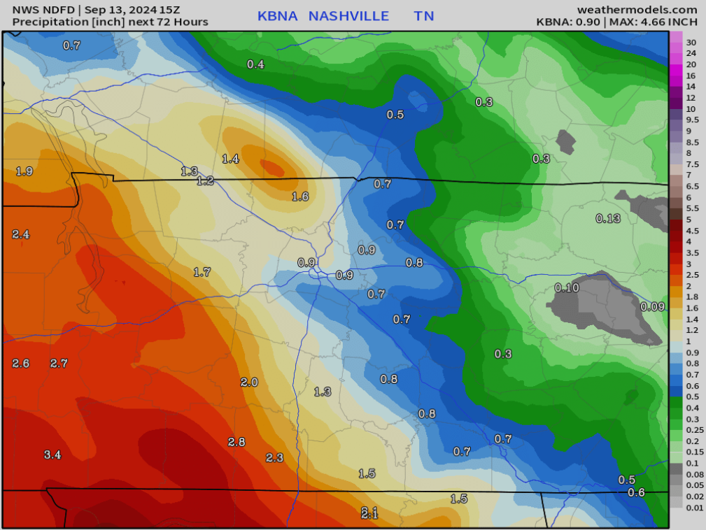
Thus far rainfall totals have been extremely disappointing, but the threat is not quite over.

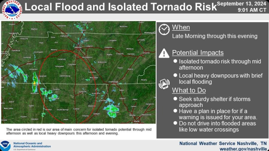
NWS Nashville has highlighted an area of concern for a local flood and isolated tornado risk which includes most of WillCo. This does not mean Nashville and Davidson Co. are in the clear, but the main area of focus will be inside the red circle.
The latest HRRR model (below) shows the majority of the rainfall staying to our SW, thus the majority of the local flood and isolated tornado risk staying to our SW. However, models can be wrong (as we have seen!) and it’ll be worth keeping an eye on the radar. We’ll be posting updates on X/IG as needed.
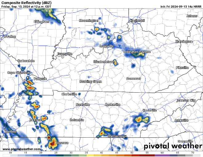
If the HRRR is right, most football games should stay dry, but again – models are imperfect! Having rain gear handy will not be a bad idea.
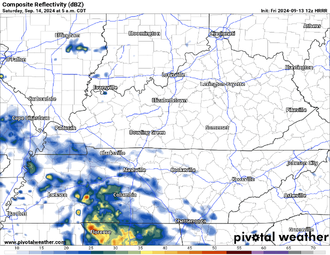
Additional showers are possible throughout the day Saturday, but no severe threat and rainfall totals look meh. Rainouts maybe possible if fields are bad at draining? Results will differ field to field.
Lesser rain chances will exist Sunday, even lower on Monday before dry weather returns mid next week.
Official rainfall totals over the next 3 days are expected to be around 1 to 1.5 inches…better than nothing, but certainly not what local crunchy grass was hoping for.
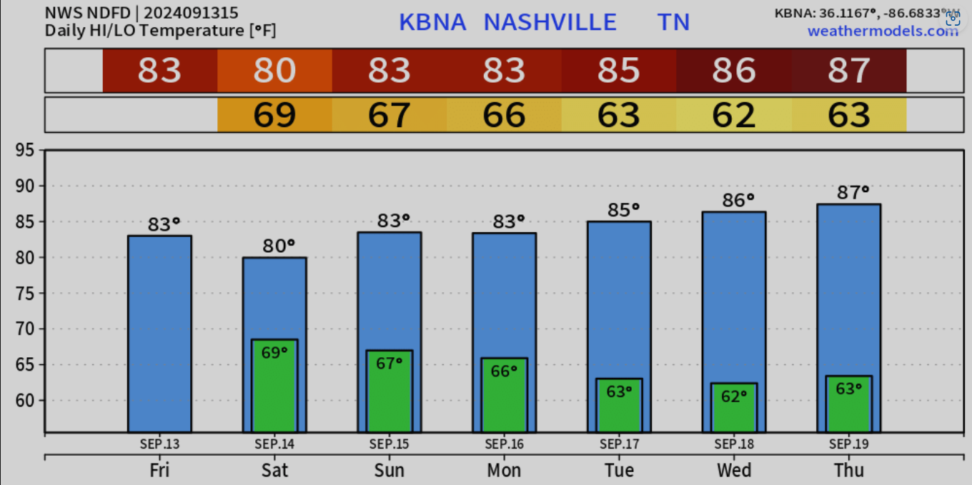
Temps to slowly warm over the next several days.
Categories: Featured Blog