


Rain from now Tropical Depression Francine is moving in and will increase in coverage throughout the day.
The latest HRRR model shows heavier rain later this afternoon, continuing into tonight.

Friday is where some uncertainty comes in.
“The main concern will be if a band of showers and storms sets up in a N/S or SE/NW orientation with cells training over the same area. As the elevated instability moves in overnight and Friday the rainfall will become more convective in nature with some very heavy downpours at times. If a band is able to setup, it could quickly produce 2-4 inches of rain.” – NWS Nashville
Where this band of heavy rainfall sets up is the million-dollar question.
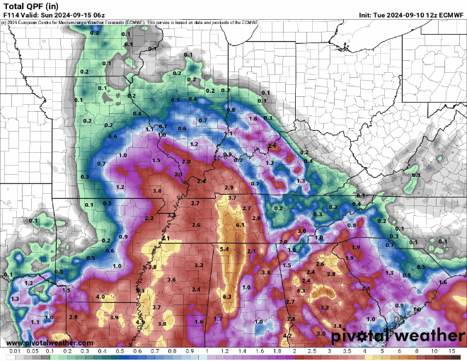
The latest Euro model runs have been trending the heavier band more towards our south – but this will have to be watched.
This band will also carry a low-end threat of a brief, weak tornado – the SPC has WillCo. and points south outlooked with a 2% chance of a tornado within 25 miles for Friday.
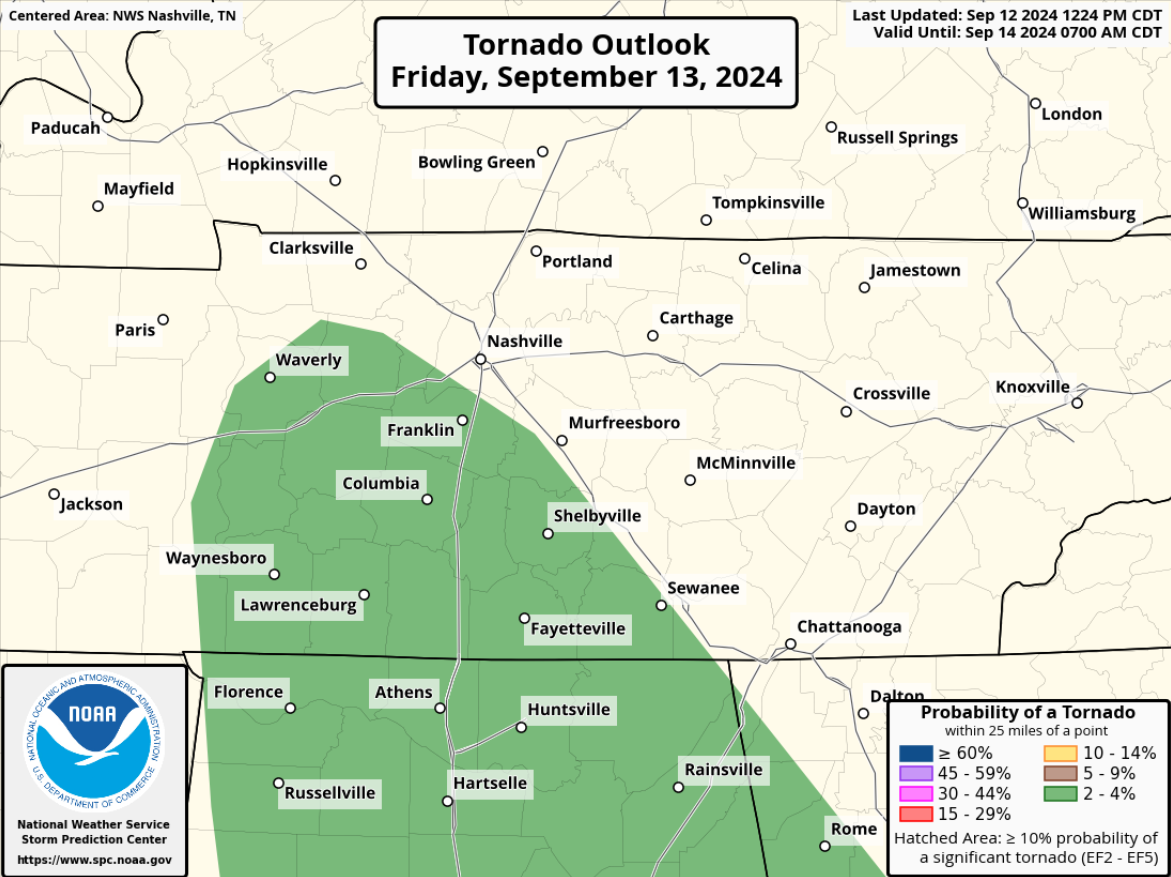
“With the general lack of overlap between the shear and low level instability, the tornado threat should be limited. If a tornado occurs, it would likely happen sometime mid morning to midday Friday, but again, the threat looks limited.” says NWS Nashville.
Rainouts appear possible for any poor-draining outdoor playing fields, and some lightning delays are possible for Friday Night Lights.
The Euro model (below) shows rainfall chances continuing thru Saturday + Sunday, decreasing by Monday.

Remain weather aware over the next couple of days, especially if you have outdoor plans.
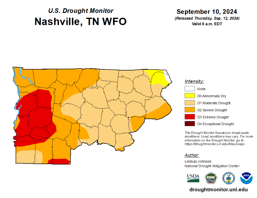
On the bright side, we do need the rain (as long as it isn’t all at once). New drought monitor shows both of our counties solidly in Moderate to Severe Drought.
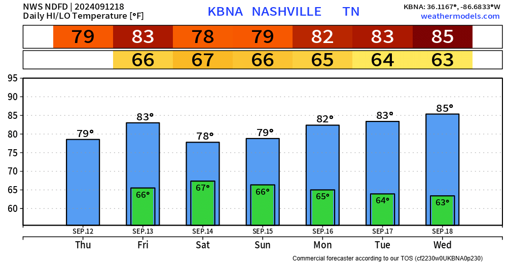
Temps stay comfortable over the next several days.
 Log In To Facebook To Comment