


The heat continues.
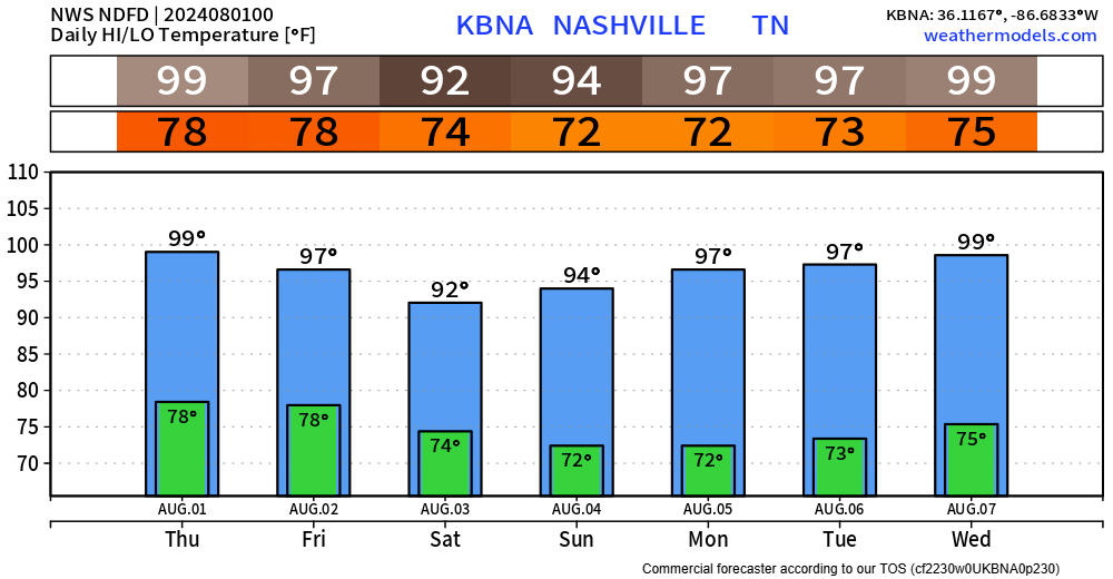
A Heat Advisory will be in effect until 7pm Thursday.
Heat index values up to 110° will be possible.
Temperatures in the upper 90s paired with dewpoints in the low to mid 70s will make already-bad upper 90s feel even worse. If outdoors, take frequent breaks in the shade, drink plenty of water and check in on friends + family who may not have air conditioning.
Models have a tough time preforming well in the pattern we are settled into right now. Soooo tough to put much faith in them.
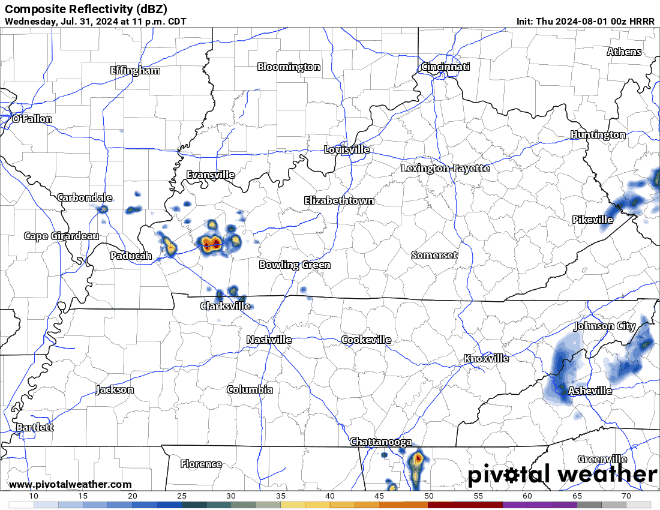
HRRR model (above) thinks we might see some thunderstorms tonight. Not really worried about severe weather with any of these, more of maybe a thunder wakes u up in the middle of the night and then turn the pillow over and go back to sleep.
Models are pretty quiet for Thursday afternoon. I think most of us stay dry but wouldn’t be surprised if a couple of folks won the Wattery.
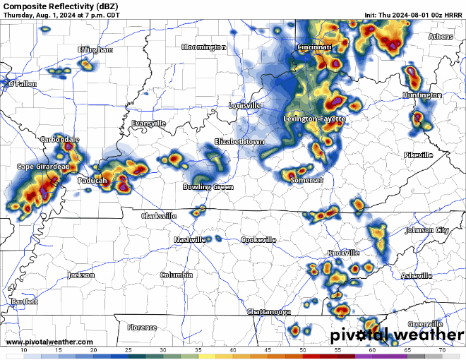
Thursday night a line of storms will be weakening as they head towards our area from the NW. HRRR model (shown below) thinks they don’t make it here. We shall see about that.
Higher rain chances exist Friday and Saturday afternoon. Severe threat very low – but any storm could contain lightning, heavy rain and gusty winds.
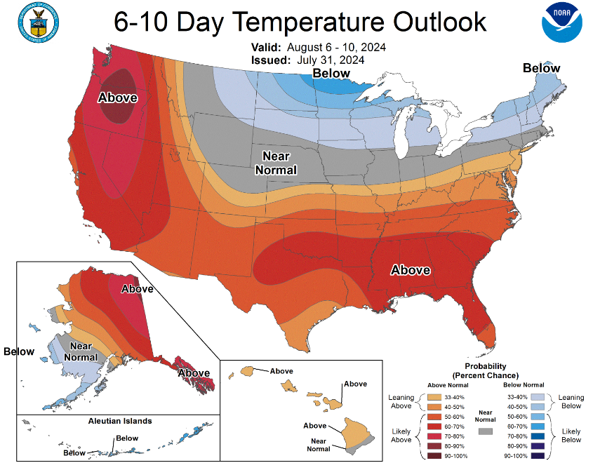
Above-average temperatures are expected to stick with us in the long term. Might be time to take a trip to International Falls.
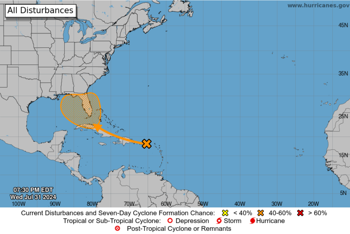
If you have any plans to travel to Florida in the next little bit, would be worth keeping an eye on the forecast. Way too far out to tell if this would have any local impacts for us.
 Log In To Facebook To Comment