


Lots to talk about.
First – hot.
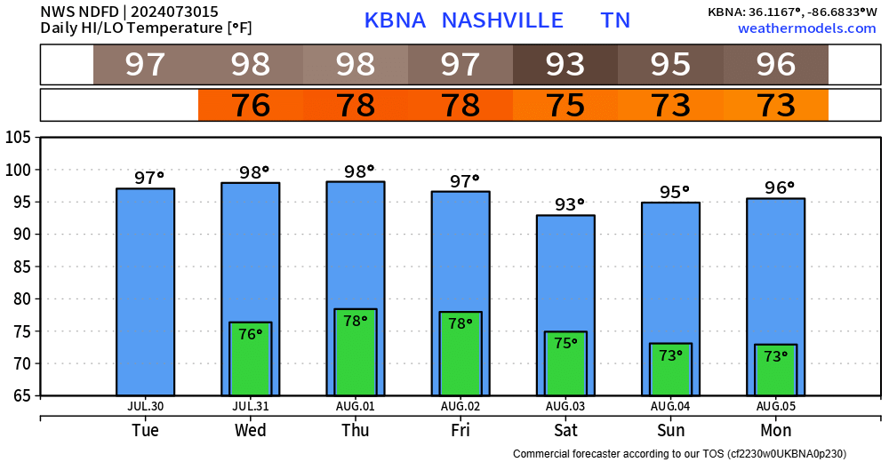
Heat Advisory will be in effect today and Wednesday from noon to 7pm.
Heat index values up to 110° possible both days.
If outdoors for long periods of time, take frequent breaks and stay hydrated. Look before you lock – never leave children or pets in a parked car.
We could see another Heat Advisory (or two) for Thursday and Friday as the gross temperature + humidity combo sticks around.
Now to the severe threat portion of the blog – which there is a lot of uncertainty about.
“A larger than usual amount of uncertainty remains regarding convective evolution this afternoon th[r]ough tonight.” – Storm Prediction Center
Similar to yesterday, there is a low-end threat for damaging straight-line winds, and a quick spin-up tornado can’t totally be ruled out (like the one in Murfreesboro yesterday).
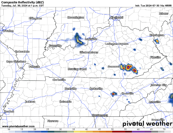
Now, I am very hesitant to include any model input, just because the models have been having a very hard time handling when/where the storms will be.
Similar to yesterday, we could see a couple of severe storms this afternoon and evening.
The HRRR model (below) shows most of the activity missing us to the east, but again – this should be taken with a grain of salt.
It’ll be important to stay weather aware thru tonight. We’ll have a better handle on things once things start to get going on radar. We’ll be tweeting as needed and will go live on YouTube if a warning is issued.
Again tomorrow, we’ll deal with uncertainty regarding storm potential. Models hinting at some possible storms (maybe strong to severe) Wednesday afternoon and evening. But again, models have been doing a poor job handling these kinds of things. It will be more of a “wait and see” kinda thing.
Rain chances will decrease as we head towards the end of the week, but we’ll still have Wattery chances to deal with in the afternoon and evening.
High temps will continue to be in the 90s thru the weekend. Dewpoints will relax a bit as we get into the weekend – making the heat slightly more tolerable.
 Log In To Facebook To Comment