
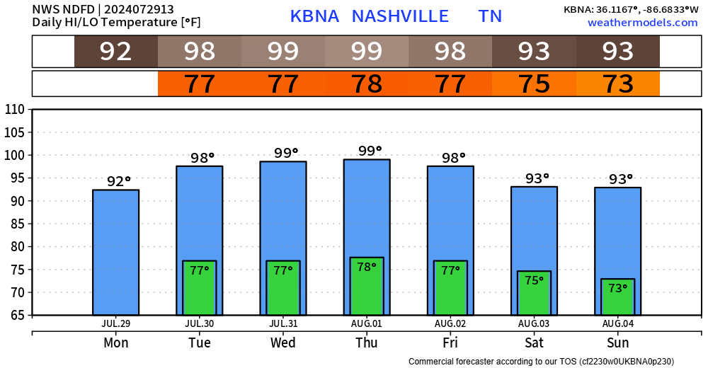
Both our counties will be under a Heat Advisory from noon to 7pm on Tuesday.
Heat index values up to 109° will be possible.
Take precautions if outdoors – take frequent breaks, drink plenty of water, wear light clothing…
Tuesday may not be the only day we need a Heat Advisory this week. Dangerous heat + humidity combo will continue thru Friday. Overnight lows in the upper 70s will provide very little relief. Check in on those who may not have access to A/C.
We’ll deal with a low-end threat of damaging straight-line winds this afternoon/evening, thanks to isolated storms moving in from the NW, shown below by the HRRR model.
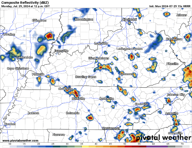
- the Storm Prediction Center has our two counties outlooked with a 5% chance of damaging straight-line winds within 25 miles
- we are not included in any tornado or hail threat
- heavy rain + lightning will be possible with any storm – if thunder roars, head indoors
- localized flooding will be possible with any slow-moving downpours
A weakening mesoscale convective system (MCS) will dive south early Tuesday morning and is expected to more be an issue for the Plateau. Models could be wrong tho. Heavy rain + gusty winds would be the main threats.
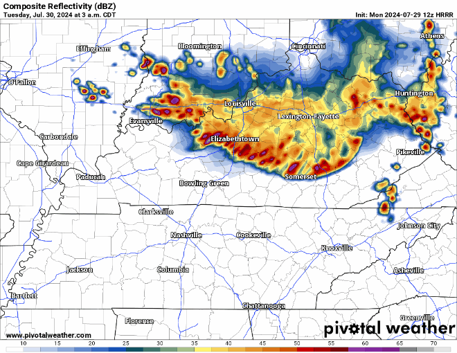
Andddd again Tuesday afternoon thru night we’ll deal with a low-end chance of damaging straight-line winds. The SPC has us outlooked with another 5% chance within 25 miles, and again, not included in any hail or tornado threat.
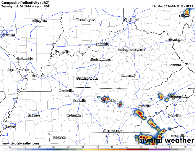
Although the HRRR model shows most of the activity missing us to the east, models can be wrong. We shall see if they start to trend one way or another.
Rain chances start to decrease as we had towards the end of the week and get into the first weekend of August.
Categories: Featured Blog