


Can’t seem to shake the daily Wattery chances – we can blame the moist, soupy airmass for that.
Each day thru the middle of next week will have:
- chances for showers/storms – mostly in the afternoon + evening
- no one knows exactly when/where they may pop-up
- lightning and heavy rain possible with any storm
- localized minor flooding possible with some of the heavier rain – watch out for ponding on roadways
- no severe weather concerns, but maybe some gusty winds in some storms
Lower rain chances Saturday, higher chances Sunday + Monday – but chances exist every day.
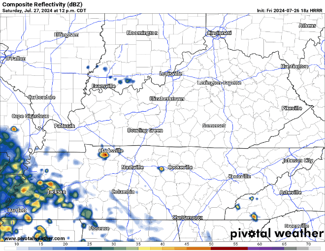
HRRR model (below) shows some winners tmrw (Saturday). Not a perfect model, but it’s a solid guess.
Today thru Tuesday all carry a 5-15% chance of flash flooding within 25 miles, with the exception of Sunday – which we have a 15 – 40% chance of flash flooding within 25 miles.
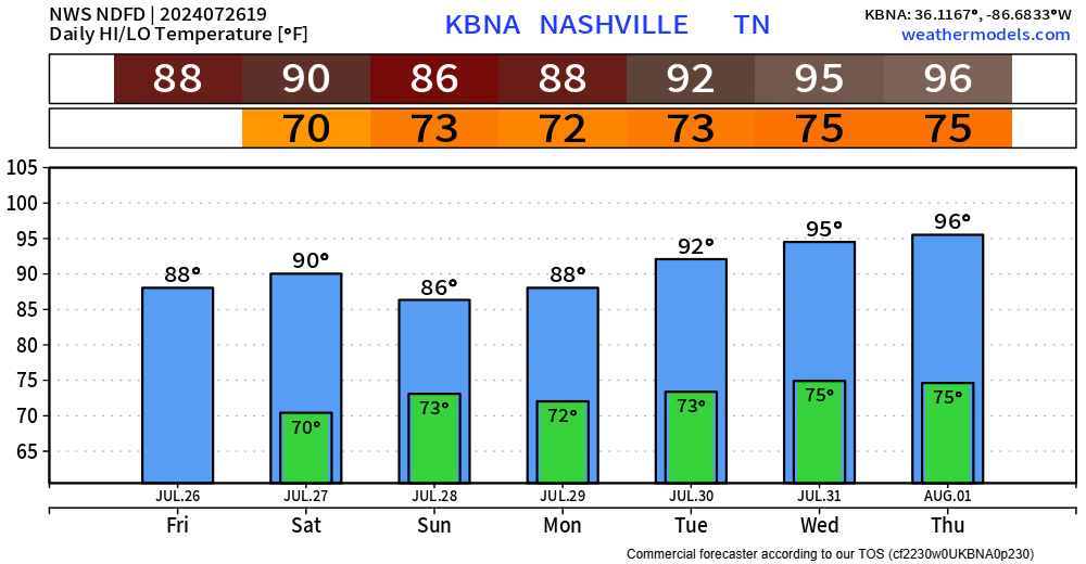
Wattery chances will slowly start to decrease as we wrap up July, just in time for the heat to turn back up. High temps back in the mid 90s by the middle of next week, heat index values back above 100°…
 Log In To Facebook To Comment