
Although pretty much everyone got at least some rain this morning, activity has been more isolated this afternoon. Some of us have picked up a decent amount of rain, others not so much.
Showers/non-severe storms will diminish in coverage as we head towards sunset tonight.
We get to do it all over again Wednesday.
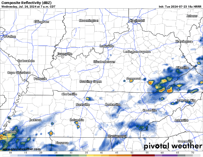
HRRR model (above) shows:
- activity getting going early, showers/storms possible as early as mid-morning, best chances along and south of I-40
- scattered rain/storm chances will continue thru the evening
- no severe weather expected, but a storm or two could contain gusty winds and frequent lightning
- localized ponding on roadways possible, but no widespread flooding issues expected
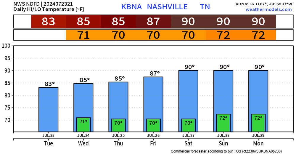
This trend will continue thru the week.
- rain chances will exist each day (especially in the afternoon + evening) thru at least Monday
- rain probabilities are a tad lower on Friday and Saturday, although chances still exists
- no severe weather in the forecast
- some localized spots could see some isolated flooding issues, but no widespread issues expected
Temperatures slowly start to creep back up towards 90° by the weekend, right on average for this time of year.
Categories: Featured Blog