
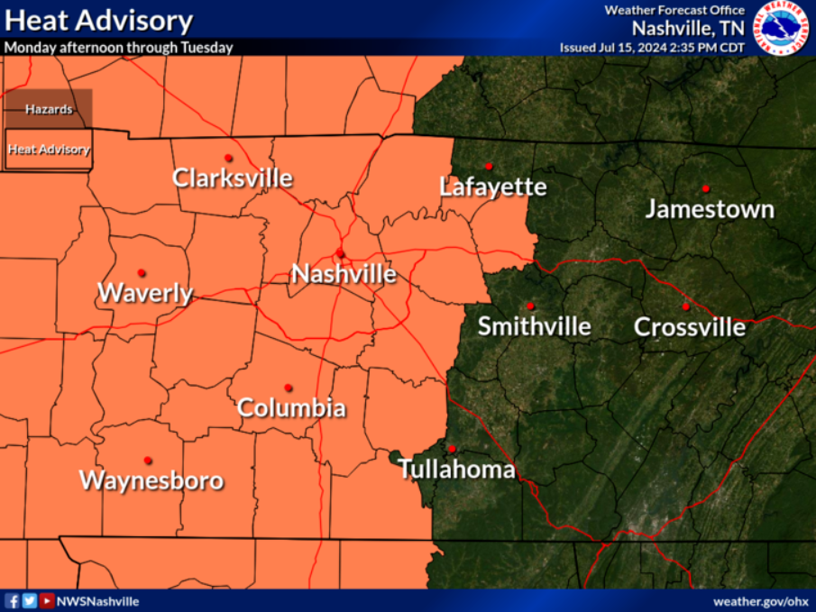
Even without the Heat Advisory, it’ll still be hot.
In hopes of cooling off, there will be an outside shot at winning the Wattery this afternoon/evening.
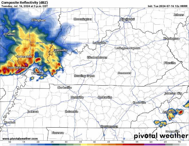
The HRRR model (above) shows the storm complex to our NW falling apart, with maybe some of us getting some rain. If a storm does surprise you, heavy rain, lightning and some gusty winds will be possible – but no severe weather expected.
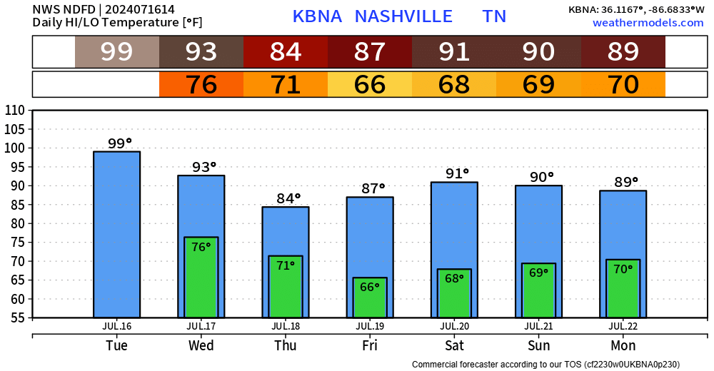
Wednesday afternoon/evening: our best rain chances for the week will exists as a cold front pushes thru the area. A storm or two could be strong with gusty winds, but lightning and heavy rain will be possible with any storm. Some lingering showers possible Thursday, but most of the activity should be to our S. Rainfall totals generally around 1.5″.

Relief from the 90s come Thursday. We’re taking it back to the 80s.

High temps will be in the 80s, and maybe briefly hit 90° for the remainder of the week.
Friday and Saturday are trending a bit drier as the cold front is expected to make it far south enough to leave us with very little rain chances.
Better rain chances return beginning of next week.
Categories: Featured Blog